
| Distance / Altitude | Location | Report Date / Time | Live Weather | Wind | Gusts | Temp. | Visibility | Cloud |
|---|---|---|---|---|---|---|---|---|
| 12 km WNW / 3 m | BUOY-DELD1 (Marine) | 2026-06-09 00:00 local (2026/06/09 04:00 GMT) | calm (4 km/h at 210) | 16°C | - | |||
| 21 km NW / 216 m | Wilmington Airport (Delaware) | 2026-06-08 22:51 local (2026/06/09 02:51 GMT) | Clear | light winds from the SE (7 km/h at 140) | 17°C | 16 | ||
| 23 km SSE / 3 m | BUOY-SJSN4 (Marine) | 2026-06-09 00:00 local (2026/06/09 04:00 GMT) | moderate winds from the SE (26 km/h at 140) | 18°C | - | |||
| 28 km WSW / 3 m | BUOY-CHCM2 (Marine) | 2026-06-09 00:00 local (2026/06/09 04:00 GMT) | calm (2 km/h at 200) | 14°C | - | |||
| 28 km WNW / 24 m | Newark (Delaware) | 2026-06-09 00:29 local (2026/06/09 04:29 GMT) | dry | calm (0 km/h at 237) | 16°C | - | - - 0 | |
| 30 km N / 31 m | Bellevue Hills (Delaware) | 2026-06-09 00:20 local (2026/06/09 04:20 GMT) | dry | calm (0 km/h at 246) | 15°C | - | - - 0 | |
| 30 km NNE / 6 m | Logan Township (New Jersey) | 2026-06-09 00:10 local (2026/06/09 04:10 GMT) | dry | calm (0 km/h at 128) | 11°C | - | - - 0 | |
| 32 km NW / 88 m | Greenville (Delaware) | 2026-06-09 00:03 local (2026/06/09 04:03 GMT) | dry | calm (0 km/h at 176) | 13°C | - | - - 0 | |
| 34 km NW / 300 m | Greenville (Delaware) | 2026-06-08 23:01 local (2026/06/09 03:01 GMT) | dry | calm (0 km/h at 43) | 14°C | - | - - 0 | |
| 34 km S / 17 m | Delaware Airpark Dover-Cheswold (Delaware) (Delaware) | 2026-06-08 23:35 local (2026/06/09 03:35 GMT) | - | calm (0 km/h at 0) | 12°C | 16 |
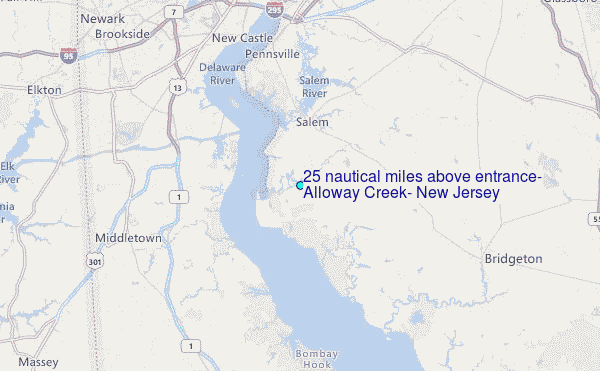
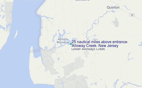
Choose 2.5 nautical miles above entrance, Alloway Creek, New Jersey Location Map Zoom:
Other Nearby Locations' tide tables and tide charts to 2.5 nautical miles above entrance, Alloway Creek, New Jersey:
click location name for more details
 Surf breaks close to 2.5 nautical miles above entrance, Alloway Creek, New Jersey:
|
||
|---|---|---|
| Closest surf break | Chodes | 49 mi |
| Second closest surf break | 57th Street | 49 mi |
| Third closest surf break | 55th Street Pier | 49 mi |
| Fourth closest surf break | 52nd Street | 49 mi |
| Fifth closest surf break | 47th Street | 49 mi |


 Nearest
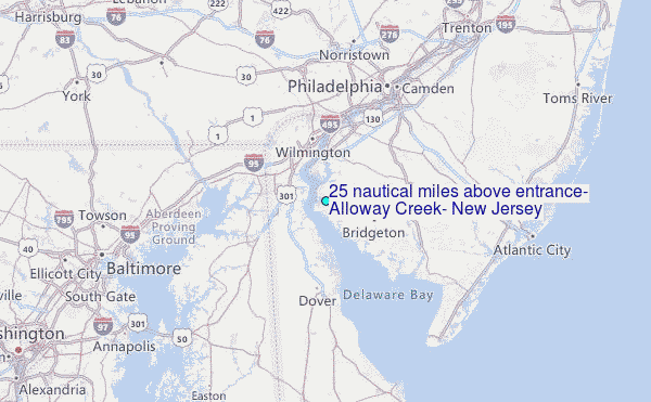