
| Distance / Altitude | Location | Report Date / Time | Live Weather | Wind | Gusts | Temp. | Visibility | Cloud |
|---|---|---|---|---|---|---|---|---|
| 6 km NW / 8 m | BlackPole (Australia) | 2026-06-09 18:30 local (2026/06/09 09:00 GMT) | - | fresh winds from the N (31 km/h at 10) | — | - | - no observation - | |
| 10 km NNE / 10 m | Waterloo Corner (Australia) | 2026-06-09 17:53 local (2026/06/09 08:23 GMT) | dry | light winds from the NE (11 km/h at 43) | 16°C | - | - - 0 | |
| 13 km E / 10 m | Parafield Airport (Australia) | 2026-06-09 18:30 local (2026/06/09 09:00 GMT) | no report | moderate winds from the NNE (26 km/h at 30) | 17°C | - | - no observation - | |
| 15 km SSE / 218 m | Adelaide International Airport (Australia) | 2026-06-09 18:00 local (2026/06/09 08:30 GMT) | - | moderate winds from the NNE (26 km/h at 30) | — | 0.0 | ||
| 15 km E / 22 m | Para Hills West (Australia) | 2026-06-09 18:51 local (2026/06/09 09:21 GMT) | dry | calm (5 km/h at 29) | 18°C | - | - - 0 | |
| 15 km ENE / 17 m | Edinburgh Raaf (Australia) | 2026-06-09 18:30 local (2026/06/09 09:00 GMT) | no report | moderate winds from the NE (24 km/h at 40) | 16°C | - | - no observation - | |
| 16 km ESE / 80 m | Adelaide (Australia) | 2026-06-09 18:36 local (2026/06/09 09:06 GMT) | dry | light winds from the NNE (16 km/h at 21) | 18°C | - | - - 0 | |
| 16 km ESE / 74 m | Hillcrest wx (Australia) | 2026-06-09 18:42 local (2026/06/09 09:12 GMT) | dry | wind obs. (14 kph from 77 degs) was rejected (- km/h at -) | 18°C | - | - - 0 | |
| 17 km E / 85 m | Salisbury Park wx (Australia) | 2026-06-09 18:41 local (2026/06/09 09:11 GMT) | dry | wind obs. (13 kph from 346 degs) was rejected (- km/h at -) | 18°C | - | - - 0 | |
| 19 km S / 8 m | Adelaide Airport (Australia) | 2026-06-09 18:30 local (2026/06/09 09:00 GMT) | no report | calm (4 km/h at 150) | 10°C | - | - - - |
| Contours: | Roads & Rivers: | Select a
tide station / surf break / city |
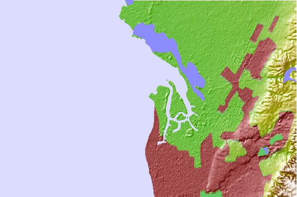
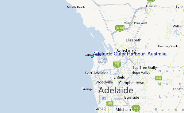
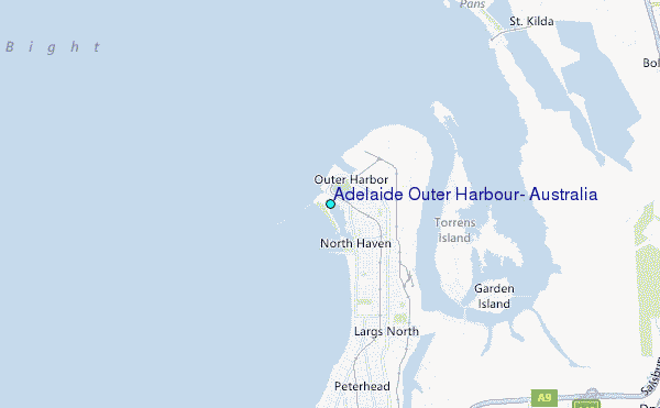
Use this relief map to navigate to tide stations, surf breaks and cities that are in the area of Adelaide Outer Harbour, Australia.
Other Nearby Locations' tide tables and tide charts to Adelaide Outer Harbour, Australia:
click location name for more details
 Surf breaks close to Adelaide Outer Harbour, Australia:
|
||
|---|---|---|
| Closest surf break | Christies Reef | 24 mi |
| Second closest surf break | Y-Steps | 25 mi |
| Third closest surf break | South Port Adelaide | 26 mi |
| Fourth closest surf break | Triggs Beach Adelaide | 27 mi |
| Fifth closest surf break | Seaford Reef | 27 mi |


 Nearest
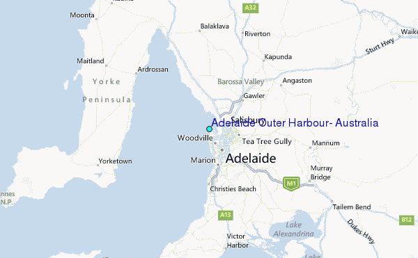