
| Distance / Altitude | Location | Report Date / Time | Live Weather | Wind | Gusts | Temp. | Visibility | Cloud |
|---|---|---|---|---|---|---|---|---|
| 25 km S / 11 m | BaseCarlini (Antarctica) | 2026-06-09 00:00 local (2026/06/09 03:00 GMT) | Mist | strong winds from the WNW (39 km/h at 290) | 2°C | 4.0 km | - overcast - | |
| 26 km SW / 52 m | Dinamet (Antarctica (ay)) | 2026-06-09 00:00 local (2026/06/09 03:00 GMT) | no report | moderate winds from the WNW (22 km/h at 300) | -3°C | - | - | |
| 34 km SW / 48 m | Centro Met. Antártico Presidente Eduardo Frei (Antarctica) | 2026-06-09 00:00 local (2026/06/09 03:00 GMT) | Fog, sky not visible, no change | moderate winds from the NW (24 km/h at 320) | 1°C | 0.4 km | - mostly cloudy - | |
| 34 km SW / 45 m | Teniente R. Marsh Airport (Chile) | 2026-06-09 00:00 local (2026/06/09 03:00 GMT) | Fog - | moderate winds from the NW (24 km/h at 320) | — | 0.4 | ||
| 83 km SSW / 111 m | Captain Arturo Prat Base (Antarctica (ay)) | 2026-06-09 00:00 local (2026/06/09 03:00 GMT) | Intermittent light drizzle | light winds from the NW (9 km/h at 320) | 1°C | 4.0 km | overcast | |
| 167 km SSE / 24 m | BaseEsperanza (Antarctica) | 2026-06-09 00:00 local (2026/06/09 03:00 GMT) | - | light winds from the N (15 km/h at 360) | 0°C | 30 km | scattered | |
| 258 km SSE / 232 m | Marambio Airport (Seymour Island) (Antarctica) | 2026-06-08 23:00 local (2026/06/09 02:00 GMT) | - | light winds from the WNW (7 km/h at 300) | — | 0.0 | ||
| 260 km SSE / 200 m | BaseMarambio (Antarctica) | 2026-06-09 00:00 local (2026/06/09 03:00 GMT) | - | calm (4 km/h at 990) | 2°C | 35 km | scattered | |
| 358 km SW / 15 m | ASCATC295E63S (Marine) | 2026-06-08 23:26 local (2026/06/09 02:26 GMT) | light winds from the N (11 km/h at 356) | — | - km | |||
| 371 km WSW / 15 m | ASCATC295E62S (Marine) | 2026-06-08 23:27 local (2026/06/09 02:27 GMT) | light winds from the NNW (15 km/h at 336) | — | - km |
| Contours: | Roads & Rivers: | Select a
tide station / surf break / city |
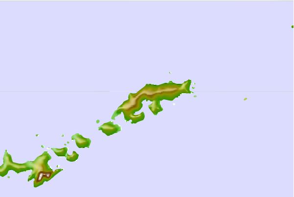

Use this relief map to navigate to tide stations, surf breaks and cities that are in the area of Admiralty Bay, South Shetlands.
Other Nearby Locations' tide tables and tide charts to Admiralty Bay, South Shetlands:
click location name for more details
 Surf breaks close to Admiralty Bay, South Shetlands:
|
||
|---|---|---|
| Closest surf break | Río Grande | 665 mi |
| Second closest surf break | Bertha's Beach | 702 mi |
| Third closest surf break | Surf Bay | 716 mi |
| Fourth closest surf break | Cow Bay | 734 mi |
| Fifth closest surf break | Elephant Beach | 738 mi |


 Nearest