
| Distance / Altitude | Location | Report Date / Time | Live Weather | Wind | Gusts | Temp. | Visibility | Cloud |
|---|---|---|---|---|---|---|---|---|
| 22 km WNW / 12 m | Linea de Base wx (Panama) | 2024-04-20 02:48 local (2024/04/20 07:48 GMT) | - | calm (2 km/h at 216) | 23°C | - | - - 0 | |
| 53 km S / 2132 m | Cerro Punta wx (Panama) | 2024-04-20 04:32 local (2024/04/20 09:32 GMT) | - | calm (2 km/h at 358) | 8°C | - | - - 0 | |
| 71 km WNW / 1 m | Cahuita wx (Costa Rica) | 2024-04-20 04:26 local (2024/04/20 09:26 GMT) | dry | calm (3 km/h at 222) | 24°C | - | - - 0 | |
| 96 km S / 71 m | Barrio Universitario wx (Panama) | 2024-04-20 04:27 local (2024/04/20 09:27 GMT) | dry | calm (0 km/h at 216) | 30°C | - | - - 0 | |
| 125 km S / 1 m | Puerto Armuelles wx (Panama) | 2024-04-20 04:23 local (2024/04/20 09:23 GMT) | - | calm (2 km/h at 81) | 28°C | - | - - 0 |
| Contours: | Roads & Rivers: | Select a
tide station / surf break / city |
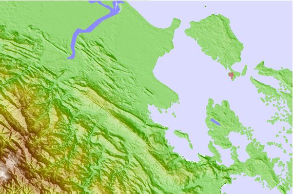
Use this relief map to navigate to tide stations, surf breaks and cities that are in the area of Almirante.
Other Nearby Locations' tide tables and tide charts to Almirante:
click location name for more details
 Surf breaks close to Almirante:
|
||
|---|---|---|
| Closest surf break | Careneros Point Break | 12 mi |
| Second closest surf break | Dumpers | 12 mi |
| Third closest surf break | Paunch Reef | 12 mi |
| Fourth closest surf break | Bluff | 13 mi |
| Fifth closest surf break | Silverbacks | 14 mi |

 Nearest