
| Distance / Altitude | Location | Report Date / Time | Live Weather | Wind | Gusts | Temp. | Visibility | Cloud |
|---|---|---|---|---|---|---|---|---|
| 13 km NNE / 7 m | Catumbela Airport (Angola) | 2024-04-20 07:00 local (2024/04/20 06:00 GMT) | - | light winds from the ENE (7 km/h at 70) | 26°C | 10.0 | few | |
| 255 km E / 1701 m | Huambo Nova Lisb (Angola) | 2024-04-20 07:00 local (2024/04/20 06:00 GMT) | Dry and partly cloudy | calm (2 km/h at 1) | 17°C | - | no cloud no observation - | |
| 261 km S / 1761 m | Lubango Mukanka Airport (Angola) | 2024-04-20 07:00 local (2024/04/20 06:00 GMT) | - | light winds from the ESE.(Wind varies from 070 to 130 degs) (7 km/h at 110) | 20°C | 10.0 | ||
| 415 km N / 70 m | Luanda Airport (Angola) | 2024-04-20 07:00 local (2024/04/20 06:00 GMT) | Dry and partly cloudy | light winds from the ESE (7 km/h at 120) | 26°C | 8.0 | scattered broken | |
| 455 km N / 42 m | Barra do Dande (Angola) | 2024-04-20 08:00 local (2024/04/20 07:00 GMT) | - | light winds from the ESE (6 km/h at 118) | — | - | - - 0 |
| Contours: | Roads & Rivers: | Select a
tide station / surf break / city |
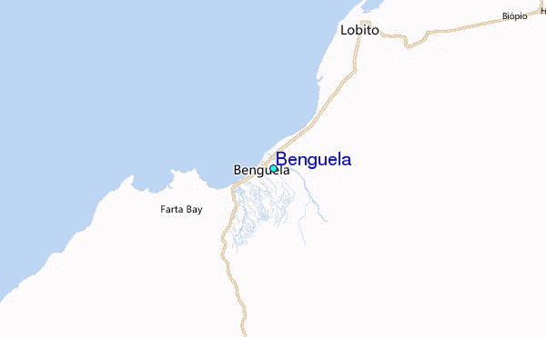
Use this relief map to navigate to tide stations, surf breaks and cities that are in the area of Benguela.
Other Nearby Locations' tide tables and tide charts to Benguela:
click location name for more details
 Surf breaks close to Benguela:
|
||
|---|---|---|
| Closest surf break | Quicombo | 91 mi |
| Second closest surf break | Sumbe | 98 mi |
| Third closest surf break | Cabo Ledo | 201 mi |
| Fourth closest surf break | Barra da Cuanza | 224 mi |
| Fifth closest surf break | Miradouro | 231 mi |

 Nearest
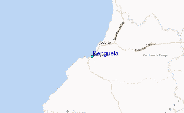