
| Distance / Altitude | Location | Report Date / Time | Live Weather | Wind | Gusts | Temp. | Visibility | Cloud |
|---|---|---|---|---|---|---|---|---|
| 60 km SE / 219 m | Dagupan (Philippines) | 2024-04-23 20:00 local (2024/04/23 12:00 GMT) | clouds developing | calm (4 km/h at 20) | 31°C | 8 | - | |
| 75 km E / 1501 m | Baguio (Philippines) | 2024-04-23 20:00 local (2024/04/23 12:00 GMT) | lightning visible, no thunder heard | wind obs. (11 kph from 140 degs) was rejected (- km/h at -) | 22°C | 7 | - | |
| 119 km S / 5 m | Iba (Philippines) | 2024-04-23 20:00 local (2024/04/23 12:00 GMT) | haze | light winds from the NW (18 km/h at 310) | 32°C | 20 | - | |
| 138 km SE / 19 m | Santa Lucia wx (Philippines) | 2024-04-23 20:20 local (2024/04/23 12:20 GMT) | dry | calm (2 km/h at 37) | 26°C | - | - - 0 | |
| 141 km NNE / 5 m | Rugsuanan wx (Philippines) | 2024-04-23 21:12 local (2024/04/23 13:12 GMT) | - | - (- km/h at ) | 34°C | - | - - 0 |
| Contours: | Roads & Rivers: | Select a
tide station / surf break / city |
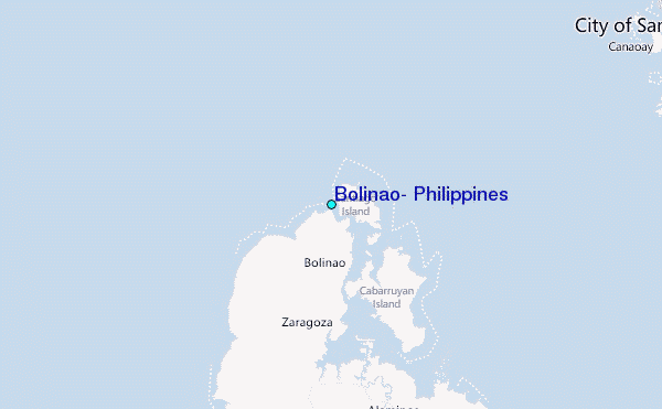
Use this relief map to navigate to tide stations, surf breaks and cities that are in the area of Bolinao, Philippines.
Other Nearby Locations' tide tables and tide charts to Bolinao, Philippines:
click location name for more details
 Surf breaks close to Bolinao, Philippines:
|
||
|---|---|---|
| Closest surf break | Bauang | 29 mi |
| Second closest surf break | Poro Point | 29 mi |
| Third closest surf break | Car-rille | 30 mi |
| Fourth closest surf break | Mona Liza Point | 33 mi |
| Fifth closest surf break | San Juan | 33 mi |

 Nearest
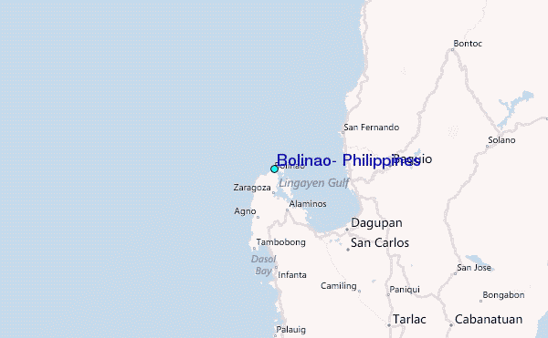