
| Distance / Altitude | Location | Report Date / Time | Live Weather | Wind | Gusts | Temp. | Visibility | Cloud |
|---|---|---|---|---|---|---|---|---|
| 54 km NE / 24 m | Pointe Noire Cs- Que (Canada) | 2026-06-08 23:00 local (2026/06/09 03:00 GMT) | no report | wind obs. (7 kph from 270 degs) was rejected (- km/h at -) | 21°C | - | - no observation - | |
| 55 km NE / 322 m | Pointe Noires Airport (Quebec) | 2026-06-08 23:00 local (2026/06/09 03:00 GMT) | - | light winds from the W (7 km/h at 270) | 21°C | 0.0 | ||
| 61 km NE / 5 m | Sept-Iles (Canada) | 2026-06-08 23:16 local (2026/06/09 03:16 GMT) | dry | calm (0 km/h at 90) | 16°C | - | - - 0 | |
| 63 km S / 195 m | Pointe Des Monts Airport (Quebec) | 2026-06-08 23:00 local (2026/06/09 03:00 GMT) | - | moderate winds from the W (20 km/h at 260) | 13°C | 0.0 | ||
| 63 km S / 6 m | Pointe -Des -Monts- Que (Canada) | 2026-06-08 23:00 local (2026/06/09 03:00 GMT) | no report | moderate winds from the W (25 km/h at 260) | 12°C | - | - - - | |
| 68 km NE / 217 m | Sept Iles Airport (Quebec) | 2026-06-08 23:00 local (2026/06/09 03:00 GMT) | Dry and cloudy | light winds from the W (13 km/h at 270) | 16°C | 24 | few broken overcast | |
| 69 km NE / 53 m | Sept-Îles (Canada) | 2026-06-09 00:00 local (2026/06/09 04:00 GMT) | no report | light winds from the WNW (6 km/h at 300) | 16°C | 0.0 | - - - | |
| 88 km SSE / 197 m | Cap Chat Airport (Quebec) | 2026-06-08 23:00 local (2026/06/09 03:00 GMT) | - | light winds from the WSW (11 km/h at 240) | 13°C | 0.0 | ||
| 93 km S / 3 m | SHIP4241 (Marine) | 2026-06-08 23:00 local (2026/06/09 03:00 GMT) | calm (2 km/h at 360) | 14°C | - | |||
| 93 km S / 15 m | SHIP7391 (Marine) | 2026-06-08 22:00 local (2026/06/09 02:00 GMT) | calm (1.8 km/h at 70) | — | - km |
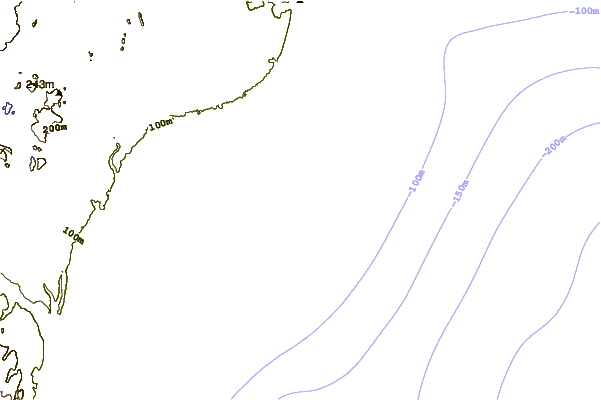
| Contours: | Roads & Rivers: | Select a
tide station / surf break / city |
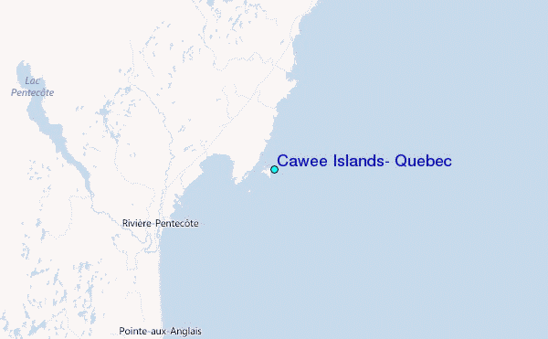
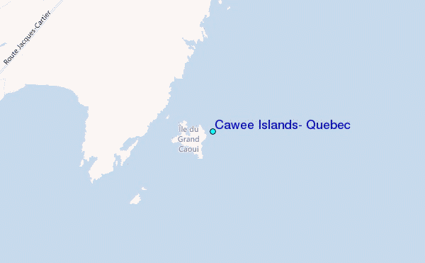
Use this relief map to navigate to tide stations, surf breaks and cities that are in the area of Cawée Islands, Quebec.
Other Nearby Locations' tide tables and tide charts to Cawée Islands, Quebec:
click location name for more details
 Surf breaks close to Cawée Islands, Quebec:
|
||
|---|---|---|
| Closest surf break | Ingonish Beach | 376 mi |
| Second closest surf break | Backyards | 397 mi |
| Third closest surf break | Minutes | 397 mi |
| Fourth closest surf break | Cow Bay | 398 mi |
| Fifth closest surf break | Lawrencetown Reef | 398 mi |


 Nearest
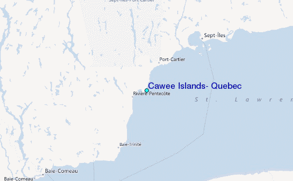