
| Distance / Altitude | Location | Report Date / Time | Live Weather | Wind | Gusts | Temp. | Visibility | Cloud |
|---|---|---|---|---|---|---|---|---|
| 11 km NNE / 26 m | Awg-1 (Netherlands) | 2026-06-09 23:00 local (2026/06/09 21:00 GMT) | Dry and partly cloudy | wind obs. (28 kph from 200 degs) was rejected (- km/h at -) | 13°C | 10.0 | few scattered - | |
| 22 km S / 219 m | Leeuwarden Air Base Airport (Netherlands) | 2026-06-09 22:25 local (2026/06/09 20:25 GMT) | Clouds dissolving | wind obs. (11 kph from 170 degs) was rejected (- km/h at -) | 11°C | 40 km | few clear - | |
| 36 km WSW / 2 m | TerschellingHoornAws (Netherlands) | 2026-06-09 23:00 local (2026/06/09 21:00 GMT) | Clear skies | light winds from the WSW (18 km/h at 250) | 11°C | 35 km | no observation | |
| 52 km ESE / 0 m | Groningen (Netherlands) | 2026-06-09 22:20 local (2026/06/09 20:20 GMT) | dry | calm (0 km/h at 157) | 11°C | - | - - 0 | |
| 55 km SE / 220 m | Groningen/Eelde Airport (Netherlands) | 2026-06-09 22:25 local (2026/06/09 20:25 GMT) | - | light winds from the S.(Wind varies from 160 to 220 degs) (13 km/h at 190) | 11°C | 10.0 | few | |
| 56 km ESE / 4 m | GroningenAPEelde (Netherlands) | 2026-06-09 23:00 local (2026/06/09 21:00 GMT) | Clouds dissolving | light winds from the S (11 km/h at 190) | 10°C | 45 km | clear | |
| 59 km SSE / 11 m | Appelscha (Netherlands) | 2026-06-09 23:04 local (2026/06/09 21:04 GMT) | dry | calm (3 km/h at 175) | 11°C | - | - - 0 | |
| 63 km SE / 10 m | Assen (Netherlands) | 2026-06-09 23:05 local (2026/06/09 21:05 GMT) | dry | calm (3 km/h at 202) | 11°C | - | - - 0 | |
| 65 km W / 50 m | L9-FF-1 offshore platform Airport (Netherlands) | 2026-06-09 22:00 local (2026/06/09 20:00 GMT) | State of sky unchanged | fresh winds from the WSW (31 km/h at 240) | 14°C | 10.0 | few overcast - | |
| 67 km SW / 219 m | Vlieland Island Airport (Netherlands) | 2026-06-09 22:25 local (2026/06/09 20:25 GMT) | Dry and cloudy | fresh winds from the WSW (31 km/h at 240) | 13°C | 10.0 | overcast |
| Contours: | Roads & Rivers: | Select a
tide station / surf break / city |

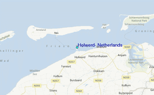
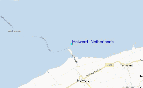
Use this relief map to navigate to tide stations, surf breaks and cities that are in the area of Holwerd, Netherlands.
Other Nearby Locations' tide tables and tide charts to Holwerd, Netherlands:
click location name for more details
 Surf breaks close to Holwerd, Netherlands:
|
||
|---|---|---|
| Closest surf break | Borkum Weststrand | 34 mi |
| Second closest surf break | Borkum Nordstrand | 35 mi |
| Third closest surf break | Jugendbad | 36 mi |
| Fourth closest surf break | FKK Stand | 38 mi |
| Fifth closest surf break | Kogerstrand (De Koog) | 51 mi |


 Nearest
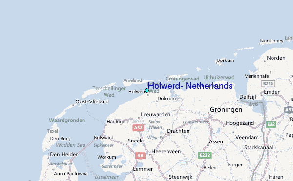