
| Distance / Altitude | Location | Report Date / Time | Live Weather | Wind | Gusts | Temp. | Visibility | Cloud |
|---|---|---|---|---|---|---|---|---|
| 2 km SSE / 9 m | Saint Johns (Florida) | 2026-06-09 12:28 local (2026/06/09 16:28 GMT) | dry | calm (0 km/h at 40) | 29°C | - | - - 0 | |
| 2 km S / 4 m | Fruit Cove (Florida) | 2026-06-09 12:22 local (2026/06/09 16:22 GMT) | dry | calm (2 km/h at 2) | 29°C | - | - - 0 | |
| 3 km N / 10 m | Jacksonville (Florida) | 2026-06-09 12:33 local (2026/06/09 16:33 GMT) | dry | calm (0 km/h at 256) | 27°C | - | - - 0 | |
| 3 km SE / 5 m | Saint Johns (Florida) | 2026-06-09 12:27 local (2026/06/09 16:27 GMT) | dry | calm (0 km/h at 0) | 28°C | - | - - 0 | |
| 8 km WNW / 3 m | BUOY-BKBF1 (Marine) | 2026-06-09 12:00 local (2026/06/09 16:00 GMT) | light winds from the E (11 km/h at 80) | 27°C | - | |||
| 9 km S / 15 m | Saint Johns (Florida) | 2026-06-09 12:35 local (2026/06/09 16:35 GMT) | dry | calm (3 km/h at 270) | 29°C | - | - - 0 | |
| 9 km NNE / 9.1 m | Jacksonville (Florida) | 2026-06-09 12:17 local (2026/06/09 16:17 GMT) | dry | calm (5 km/h at 121) | 28°C | - | - - 0 | |
| 10 km W / 19 m | Meadowbrook Terrace wx (United States) | 2026-06-09 12:17 local (2026/06/09 16:17 GMT) | dry | calm (5 km/h at 32) | 29°C | - | - - 0 | |
| 10 km NW / 219 m | Jacksonville Naval Air Station Airport (Florida) | 2026-06-09 10:53 local (2026/06/09 14:53 GMT) | Dry and cloudy | light winds from the NE (11 km/h at 50) | 27°C | 16 | scattered broken overcast | |
| 13 km WSW / 31 m | Lakeside wx (United States) | 2026-06-09 12:35 local (2026/06/09 16:35 GMT) | dry | wind obs. (6 kph from 150 degs) was rejected (- km/h at -) | 29°C | - | - - 0 |
| Contours: | Roads & Rivers: | Select a
tide station / surf break / city |
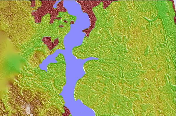
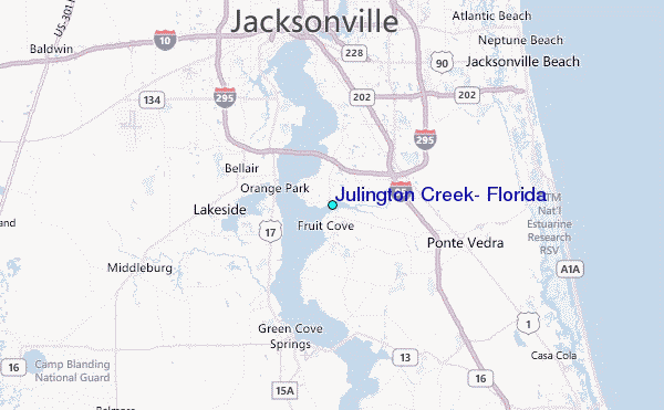
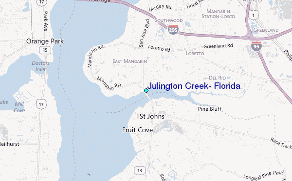
Use this relief map to navigate to tide stations, surf breaks and cities that are in the area of Julington Creek, Florida.
Other Nearby Locations' tide tables and tide charts to Julington Creek, Florida:
click location name for more details
 Surf breaks close to Julington Creek, Florida:
|
||
|---|---|---|
| Closest surf break | Crossroads | 17 mi |
| Second closest surf break | Fluidgroove Reef | 17 mi |
| Third closest surf break | Ponte Vedra | 17 mi |
| Fourth closest surf break | Middle Access | 18 mi |
| Fifth closest surf break | 7th Avenue | 18 mi |


 Nearest
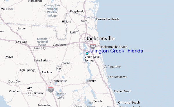