
| Distance / Altitude | Location | Report Date / Time | Live Weather | Wind | Gusts | Temp. | Visibility | Cloud |
|---|---|---|---|---|---|---|---|---|
| 87 km WNW / 129 m | Malacca (Malaysia) | 2024-04-24 11:00 local (2024/04/24 03:00 GMT) | Haze | wind obs. (11 kph from 100 degs) was rejected (- km/h at -) | 32°C | 10.0 | few mostly cloudy - | |
| 89 km ESE / 40 m | Johore Bharu/Senai (Malaysia) | 2024-04-24 11:00 local (2024/04/24 03:00 GMT) | distant precipitation but not falling at station | wind obs. (6 kph from 70 degs) was rejected (- km/h at -) | 32°C | 10 | - mostly cloudy - | |
| 90 km ESE / 217 m | Johore Bharu/Senai Airport (Malaysia) | 2024-04-24 11:44 local (2024/04/24 03:44 GMT) | Thunderstorm heavy rain thunderstorm | wind obs. (15 kph from 1 degs) was rejected (- km/h at -) | 29°C | 0.0 | few few scattered | |
| 117 km ESE / 172 m | Singapore/Seletar Airport (Singapore) | 2024-04-24 11:32 local (2024/04/24 03:32 GMT) | Thunderstorm - in the vicinity | light winds from the SSE.(Wind varies from 120 to 210 degs) (15 km/h at 160) | 32°C | 10.0 | few scattered broken | |
| 125 km ESE / 171 m | Paya Lebar Airport (Singapore) | 2024-04-24 11:00 local (2024/04/24 03:00 GMT) | Dry and partly cloudy | light winds from the SSE (19 km/h at 150) | 31°C | 10.0 | few broken |
| Contours: | Roads & Rivers: | Select a
tide station / surf break / city |
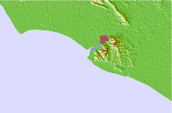
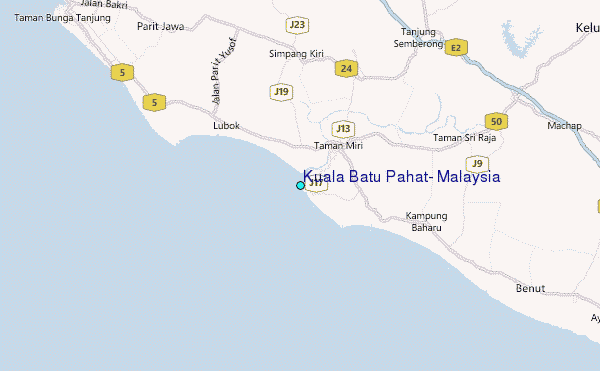
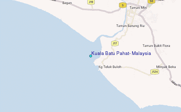
Use this relief map to navigate to tide stations, surf breaks and cities that are in the area of Kuala Batu Pahat, Malaysia.
Other Nearby Locations' tide tables and tide charts to Kuala Batu Pahat, Malaysia:
click location name for more details
 Surf breaks close to Kuala Batu Pahat, Malaysia:
|
||
|---|---|---|
| Closest surf break | Tioman Island | 115 mi |
| Second closest surf break | Cherating | 165 mi |
| Third closest surf break | Kijal | 180 mi |
| Fourth closest surf break | Kelulut (Marang) | 234 mi |
| Fifth closest surf break | Batu Buruk | 245 mi |

 Nearest
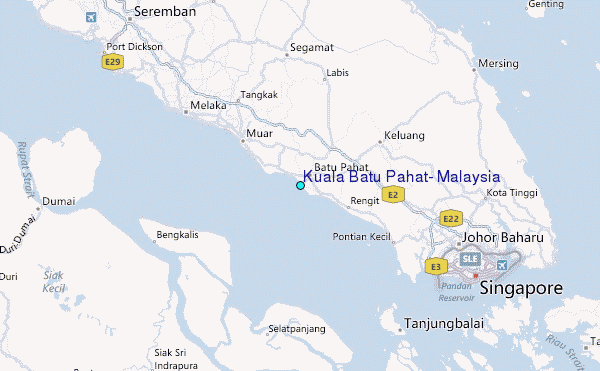