
| Distance / Altitude | Location | Report Date / Time | Live Weather | Wind | Gusts | Temp. | Visibility | Cloud |
|---|---|---|---|---|---|---|---|---|
| 9 km NE / 106 m | MangaloreBajpe (India) | 2024-04-25 23:30 local (2024/04/25 18:00 GMT) | - | calm (0 km/h at 0) | 30°C | 4 km | - scattered - | |
| 14 km NNE / 103 m | Mangalore International Airport (Bajpe) (India) | 2024-04-26 01:00 local (2024/04/25 19:30 GMT) | - | calm (0 km/h at 0) | 28°C | 6.0 | few | |
| 130 km SE / 76 m | Kannur International Airport (India) | 2024-04-26 01:00 local (2024/04/25 19:30 GMT) | Mist - | light winds from the N (6 km/h at 1) | 31°C | 4.0 | few | |
| 164 km NW / 218 m | Honavar (India) | 2024-04-25 23:30 local (2024/04/25 18:00 GMT) | - | calm (2 km/h at 270) | 29°C | 4 km | few | |
| 206 km SSE / 217 m | Kozhikode (India) | 2024-04-25 23:30 local (2024/04/25 18:00 GMT) | - | calm (0 km/h at 0) | 32°C | 4 km | scattered |
| Contours: | Roads & Rivers: | Select a
tide station / surf break / city |
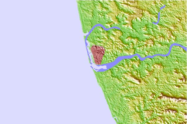
Use this relief map to navigate to tide stations, surf breaks and cities that are in the area of Mangalore, India.
Other Nearby Locations' tide tables and tide charts to Mangalore, India:
click location name for more details
 Surf breaks close to Mangalore, India:
|
||
|---|---|---|
| Closest surf break | Kaup Beach | 27 mi |
| Second closest surf break | Maravanthe Beach | 61 mi |
| Third closest surf break | Murudeshwara Beach | 89 mi |
| Fourth closest surf break | Om Beach (Gokarna) | 121 mi |
| Fifth closest surf break | Kudle -Beach (Gokarna) | 121 mi |

 Nearest