
| Distance / Altitude | Location | Report Date / Time | Live Weather | Wind | Gusts | Temp. | Visibility | Cloud |
|---|---|---|---|---|---|---|---|---|
| 59 km SSW / 15 m | ASCATB291E56S (Marine) | 2024-04-24 23:11 local (2024/04/25 02:11 GMT) | moderate winds from the NE (26 km/h at 47) | — | - km | |||
| 71 km NNE / 18 m | Puerto Williams (Chile) | 2024-04-25 00:00 local (2024/04/25 03:00 GMT) | no report | moderate winds from the ESE (22 km/h at 110) | 7°C | - | - no observation - | |
| 72 km S / 15 m | ASCATB292E56S (Marine) | 2024-04-24 23:10 local (2024/04/25 02:10 GMT) | fresh winds from the NE (30 km/h at 53) | — | - km | |||
| 77 km N / 57 m | Ushuaia Aero (Argentina) | 2024-04-25 00:00 local (2024/04/25 03:00 GMT) | no report | - (- km/h at -) | 7°C | 30 | - | |
| 77 km N / 57 m | UshuaiaAero (Argentina) | 2024-04-25 00:00 local (2024/04/25 03:00 GMT) | - | light winds from the (6 km/h at 990) | 7°C | 50 km | - scattered - |

| Contours: | Roads & Rivers: | Select a
tide station / surf break / city |
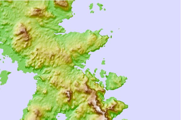
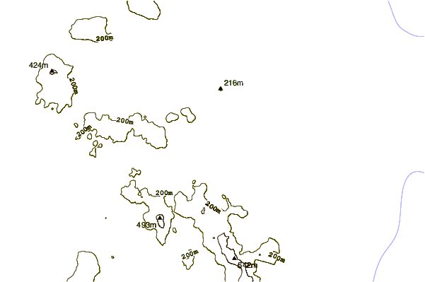
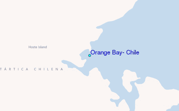
Use this relief map to navigate to tide stations, surf breaks and cities that are in the area of Orange Bay, Chile.
Other Nearby Locations' tide tables and tide charts to Orange Bay, Chile:
click location name for more details
 Surf breaks close to Orange Bay, Chile:
|
||
|---|---|---|
| Closest surf break | Río Grande | 121 mi |
| Second closest surf break | Bertha's Beach | 468 mi |
| Third closest surf break | Elephant Beach | 475 mi |
| Fourth closest surf break | Concirdia Bay | 486 mi |
| Fifth closest surf break | Surf Bay | 498 mi |

 Nearest