
| Distance / Altitude | Location | Report Date / Time | Live Weather | Wind | Gusts | Temp. | Visibility | Cloud |
|---|---|---|---|---|---|---|---|---|
| 2 km W / 15 m | Greenfield wx (United States) | 2026-06-09 01:11 local (2026/06/09 05:11 GMT) | dry | calm (0 km/h at 0) | 24°C | - | - - 0 | |
| 5 km ESE / 6 m | Neptune Beach wx (United States) | 2026-06-09 01:23 local (2026/06/09 05:23 GMT) | dry | calm (0 km/h at 86) | 26°C | - | - - 0 | |
| 6 km SW / 3 m | SHIP3218 (Marine) | 2026-06-09 01:00 local (2026/06/09 05:00 GMT) | - (- km/h at -) | 25°C | - | |||
| 6 km N / 3 m | BUOY-LTJF1 (Marine) | 2026-06-09 01:00 local (2026/06/09 05:00 GMT) | - (- km/h at -) | 26°C | 10.9 | |||
| 6 km S / 10 m | Isle of Palms South wx (United States) | 2026-06-09 01:19 local (2026/06/09 05:19 GMT) | dry | calm (0 km/h at 107) | 24°C | - | - - 0 | |
| 6 km SW / 3 m | SHIP9863 (Marine) | 2026-06-09 00:00 local (2026/06/09 04:00 GMT) | - (- km/h at -) | 25°C | - | |||
| 6 km SW / 3 m | SHIP4782 (Marine) | 2026-06-09 00:00 local (2026/06/09 04:00 GMT) | - (- km/h at -) | 25°C | - | |||
| 6 km SW / 3 m | SHIP8874 (Marine) | 2026-06-09 00:00 local (2026/06/09 04:00 GMT) | - (- km/h at -) | 25°C | - | |||
| 6 km SW / 15 m | SHIP5462 (Marine) | 2026-06-09 01:00 local (2026/06/09 05:00 GMT) | - (- km/h at -) | — | - km | |||
| 6 km SW / 3 m | SHIP6316 (Marine) | 2026-06-09 00:00 local (2026/06/09 04:00 GMT) | - (- km/h at -) | 25°C | - |
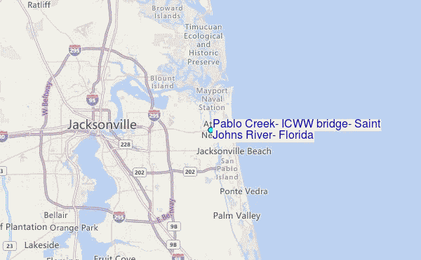
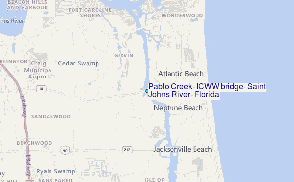
Choose Pablo Creek, ICWW bridge, Saint Johns River, Florida Location Map Zoom:
| Contours: | Roads & Rivers: | Select a
tide station / surf break / city |
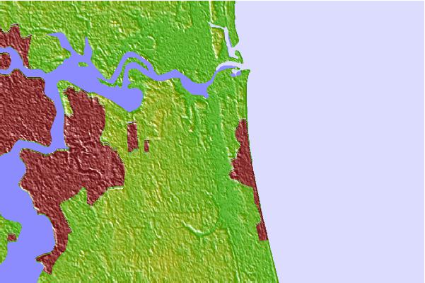
Use this relief map to navigate to tide stations, surf breaks and cities that are in the area of Pablo Creek, ICWW bridge, Saint Johns River, Florida.
Other Nearby Locations' tide tables and tide charts to Pablo Creek, ICWW bridge, Saint Johns River, Florida:
click location name for more details
 Surf breaks close to Pablo Creek, ICWW bridge, Saint Johns River, Florida:
|
||
|---|---|---|
| Closest surf break | Jax Beach Pier | 2 mi |
| Second closest surf break | 7th Avenue | 4 mi |
| Third closest surf break | Hanna Park/Mayport Poles | 4 mi |
| Fourth closest surf break | Ponte Vedra | 4 mi |
| Fifth closest surf break | The Barge | 4 mi |


 Nearest
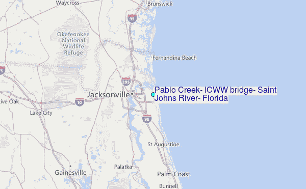