
| Distance / Altitude | Location | Report Date / Time | Live Weather | Wind | Gusts | Temp. | Visibility | Cloud |
|---|---|---|---|---|---|---|---|---|
| 1 km SE / 3 m | BUOY-PSLC1 (Marine) | 2026-06-09 06:00 local (2026/06/09 13:00 GMT) | - (- km/h at -) | — | - | |||
| 2 km ESE / 3 m | BUOY-CPXC1 (Marine) | 2026-06-09 06:16 local (2026/06/09 13:16 GMT) | light winds from the NNE (11 km/h at 20) | 12°C | - | |||
| 9 km W / 3 m | Diablo Canyon- CA (Marine) | 2026-06-09 06:26 local (2026/06/09 13:26 GMT) | - (- km/h at -) | — | - | |||
| 13 km ENE / 216 m | San Luis Obispo Airport (California) | 2026-06-09 04:56 local (2026/06/09 11:56 GMT) | - | light winds from the NW (6 km/h at 310) | 12°C | 13 | few | |
| 34 km SSW / 3 m | Santa Maria Buoy (Marine) | 2026-06-09 06:30 local (2026/06/09 13:30 GMT) | light winds from the NNW (18 km/h at 340) | 13°C | - | |||
| 38 km SSW / - m | SHIP895 (ocean) | 2026-06-09 05:00 local (2026/06/09 12:00 GMT) | - | moderate winds from the N (22 km/h at 350) | 13°C | - | no observation | |
| 38 km SSW / - m | SHIP849 (ocean) | 2026-06-09 06:00 local (2026/06/09 13:00 GMT) | - | light winds from the N (18 km/h at 360) | 13°C | - | no observation | |
| 38 km SSW / - m | SHIP1837 (ocean) | 2026-06-09 05:00 local (2026/06/09 12:00 GMT) | - | moderate winds from the N (22 km/h at 360) | 13°C | - | no observation | |
| 38 km SSW / - m | SHIP1213 (ocean) | 2026-06-09 06:00 local (2026/06/09 13:00 GMT) | - | light winds from the N (18 km/h at 360) | 13°C | - | no observation | |
| 38 km SSW / - m | SHIP162 (ocean) | 2026-06-09 06:00 local (2026/06/09 13:00 GMT) | - | light winds from the N (18 km/h at 360) | 13°C | - | no observation |
| Contours: | Roads & Rivers: | Select a
tide station / surf break / city |
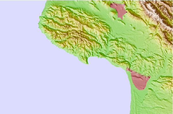
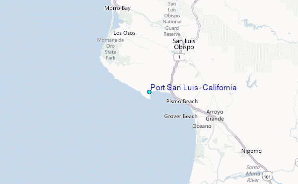
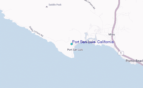
Use this relief map to navigate to tide stations, surf breaks and cities that are in the area of Port San Luis, California.
Other Nearby Locations' tide tables and tide charts to Port San Luis, California:
click location name for more details
 Surf breaks close to Port San Luis, California:
|
||
|---|---|---|
| Closest surf break | Avila Beach | 1 mi |
| Second closest surf break | Saint Annes | 2 mi |
| Third closest surf break | Sewers | 4 mi |
| Fourth closest surf break | Pismo Beach Pier | 7 mi |
| Fifth closest surf break | Oceano | 9 mi |


 Nearest
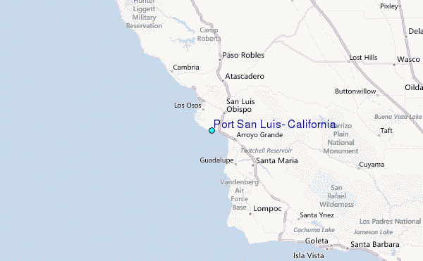