
| Distance / Altitude | Location | Report Date / Time | Live Weather | Wind | Gusts | Temp. | Visibility | Cloud |
|---|---|---|---|---|---|---|---|---|
| 19 km S / 52 m | Machala Larrea Airport (Ecuador) | 2026-06-09 15:00 local (2026/06/09 20:00 GMT) | Dry and partly cloudy | calm (2 km/h at 310) | 28°C | 10.0 | few broken - | |
| 53 km SW / 158 m | Tumbes Pedro Canga Rodríguez Airport (Peru) | 2026-06-09 15:00 local (2026/06/09 20:00 GMT) | Dry and partly cloudy | light winds from the NE (9 km/h at 40) | 28°C | 10.0 | broken | |
| 107 km SE / 1237 m | Ciudad de Catamayo Airport (Ecuador) | 2026-06-09 15:00 local (2026/06/09 20:00 GMT) | Dry and cloudy | calm (4 km/h at 320) | 22°C | 10.0 | scattered overcast overcast | |
| 123 km ENE / 2531 m | Cuenca/Mariscal Airport (Ecuador) | 2026-06-09 15:00 local (2026/06/09 20:00 GMT) | - | wind obs. (11 kph from 210 degs) was rejected (- km/h at -) | — | 10.0 | broken broken - | |
| 126 km N / 211 m | Guayaquil/José Joaquín de Olmedo International Airport (Ecuador) | 2026-06-09 15:00 local (2026/06/09 20:00 GMT) | Dry and partly cloudy | wind obs. (11 kph from 160 degs) was rejected (- km/h at -) | 30°C | 10.0 | scattered broken | |
| 155 km E / 926 m | Gualaquiza (Ecuador) | 2026-06-09 16:00 local (2026/06/09 21:00 GMT) | - | light winds from the NNW (6 km/h at 330) | — | 32 km | overcast | |
| 160 km WNW / 8 m | Salinas/Gen Ulpi Airport (Ecuador) | 2026-06-09 15:00 local (2026/06/09 20:00 GMT) | Dry and partly cloudy | light winds from the S (13 km/h at 170) | 28°C | 10.0 | scattered scattered broken | |
| 200 km SSW / 220 m | Talara/Cap. FAP Víctor Montes Arias International Airport (Peru) | 2026-06-09 15:00 local (2026/06/09 20:00 GMT) | - | light winds from the W (15 km/h at 260) | — | 0.0 | ||
| 220 km S / 1 m | Piura/Capitán FAP Guillermo Concha Iberico International Airport (Peru) | 2026-06-09 15:00 local (2026/06/09 20:00 GMT) | - | light winds from the SSW (7 km/h at 200) | — | 0.0 | ||
| 235 km NE / 2796 m | Riobamba/Chimborazo Airport (Ecuador) | 2026-06-09 15:00 local (2026/06/09 20:00 GMT) | - | wind obs. (9 kph from 20 degs) was rejected (- km/h at -) | — | 6.0 | broken overcast - |
| Contours: | Roads & Rivers: | Select a
tide station / surf break / city |
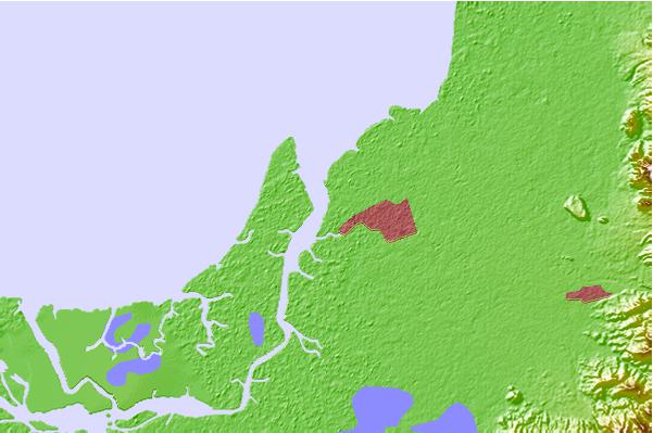
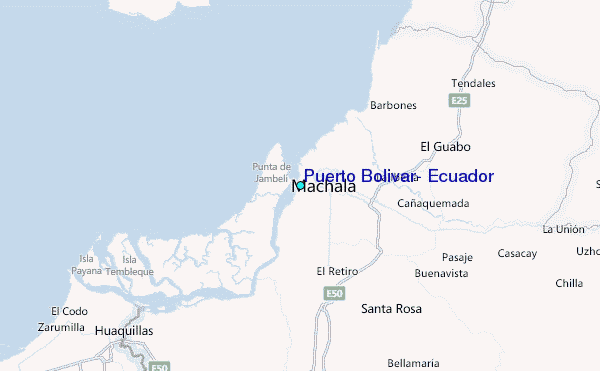
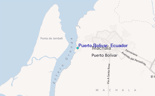
Use this relief map to navigate to tide stations, surf breaks and cities that are in the area of Puerto Bolivar, Ecuador.
Other Nearby Locations' tide tables and tide charts to Puerto Bolivar, Ecuador:
click location name for more details
 Surf breaks close to Puerto Bolivar, Ecuador:
|
||
|---|---|---|
| Closest surf break | La Puntilla | 48 mi |
| Second closest surf break | Chabela (Playas de villamil) | 52 mi |
| Third closest surf break | Olas Verdes | 52 mi |
| Fourth closest surf break | Sharkbay | 52 mi |
| Fifth closest surf break | Zorritos | 55 mi |


 Nearest
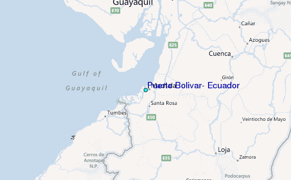