
| Distance / Altitude | Location | Report Date / Time | Live Weather | Wind | Gusts | Temp. | Visibility | Cloud |
|---|---|---|---|---|---|---|---|---|
| 13 km SE / 175 m | Trujillo Airport (Honduras) | 2026-06-09 06:23 local (2026/06/09 12:23 GMT) | - | calm (0 km/h at 0) | 29°C | 10.0 | few | |
| 61 km WNW / 32 m | Roatan (Honduras) | 2026-06-09 06:37 local (2026/06/09 12:37 GMT) | dry | wind obs. (6 kph from 272 degs) was rejected (- km/h at -) | 29°C | - | - - 0 | |
| 63 km WNW / 230 m | Roatan (Honduras) | 2026-06-09 06:00 local (2026/06/09 12:00 GMT) | Dry and partly cloudy | moderate winds from the E (22 km/h at 100) | 28°C | 10.0 | scattered - - | |
| 79 km W / 15 m | SHIP5094 (Marine) | 2026-06-09 06:00 local (2026/06/09 12:00 GMT) | - (- km/h at -) | — | - km | |||
| 93 km SW / 378 m | La Ceiba/Goloson International Airport (Honduras) | 2026-06-09 05:00 local (2026/06/09 11:00 GMT) | Dry and partly cloudy | calm (0 km/h at 0) | 25°C | 10.0 | scattered broken | |
| 79 km W / 3 m | SHIP4684 (Marine) | 2026-06-09 06:00 local (2026/06/09 12:00 GMT) | - (- km/h at -) | 28°C | - | |||
| 79 km W / 3 m | SHIP4866 (Marine) | 2026-06-09 06:00 local (2026/06/09 12:00 GMT) | - (- km/h at -) | 28°C | - | |||
| 90 km WNW / 3 m | SHIP7263 (Marine) | 2026-06-09 05:00 local (2026/06/09 11:00 GMT) | - (- km/h at -) | 28°C | - | |||
| 90 km WNW / 3 m | SHIP2319 (Marine) | 2026-06-09 05:00 local (2026/06/09 11:00 GMT) | - (- km/h at -) | 28°C | - | |||
| 90 km WNW / 15 m | SHIP2497 (Marine) | 2026-06-09 05:00 local (2026/06/09 11:00 GMT) | - (- km/h at -) | — | - km |
| Contours: | Roads & Rivers: | Select a
tide station / surf break / city |
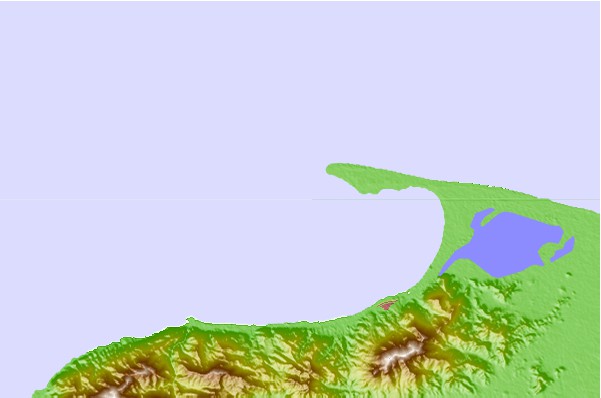
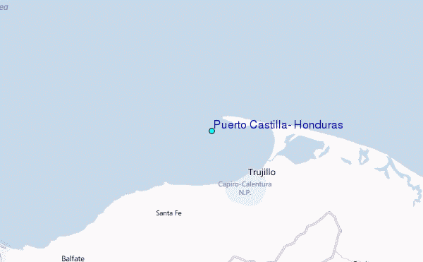
Use this relief map to navigate to tide stations, surf breaks and cities that are in the area of Puerto Castilla, Honduras.
Other Nearby Locations' tide tables and tide charts to Puerto Castilla, Honduras:
click location name for more details
 Surf breaks close to Puerto Castilla, Honduras:
|
||
|---|---|---|
| Closest surf break | Palma Real | 34 mi |
| Second closest surf break | East Point Long Cay | 173 mi |
| Third closest surf break | San Pedro South Reef Pass | 183 mi |
| Fourth closest surf break | San Pedro North Reef Pass | 184 mi |
| Fifth closest surf break | Rocky Point | 188 mi |


 Nearest
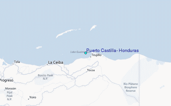