
| Distance / Altitude | Location | Report Date / Time | Live Weather | Wind | Gusts | Temp. | Visibility | Cloud |
|---|---|---|---|---|---|---|---|---|
| 28 km ENE / 215 m | Hydaburg Airport (Alaska) | 2026-06-08 19:16 local (2026/06/09 03:16 GMT) | Dry and cloudy | light winds from the ESE (11 km/h at 120) | 12°C | 16 | broken overcast | |
| 45 km N / 3 m | BUOY-CRGA2 (Marine) | 2026-06-08 20:24 local (2026/06/09 04:24 GMT) | light winds from the SE (8 km/h at 140) | 11°C | - | |||
| 58 km N / 206 m | Klawock Airport (Alaska) | 2026-06-08 18:53 local (2026/06/09 02:53 GMT) | Dry and cloudy | calm (0 km/h at 0) | 14°C | 16 | few broken overcast | |
| 87 km NE / 3 m | BUOY-SPXA2 (Marine) | 2026-06-08 20:32 local (2026/06/09 04:32 GMT) | light winds from the SE (11 km/h at 140) | 12°C | - | |||
| 90 km SE / 15 m | SHIP6560 (Marine) | 2026-06-08 20:00 local (2026/06/09 04:00 GMT) | - (- km/h at -) | — | - km | |||
| 90 km SE / - m | SHIP1651 (ocean) | 2026-06-08 20:00 local (2026/06/09 04:00 GMT) | - | light winds from the NNW (11 km/h at 340) | 10°C | - | no observation | |
| 90 km SE / 15 m | SHIP3456 (Marine) | 2026-06-08 20:00 local (2026/06/09 04:00 GMT) | - (- km/h at -) | — | - km | |||
| 90 km SE / - m | SHIP588 (ocean) | 2026-06-08 20:00 local (2026/06/09 04:00 GMT) | - | light winds from the NNW (11 km/h at 340) | 10°C | - | no observation | |
| 91 km S / 49 m | Langara Island Rcs- BC (Canada) | 2026-06-08 20:00 local (2026/06/09 04:00 GMT) | no report | light winds from the SW (14 km/h at 220) | 9°C | - | - no observation - | |
| 91 km S / 205 m | Langara Airport (British Columbia) | 2026-06-08 19:00 local (2026/06/09 03:00 GMT) | - | calm (4 km/h at 10) | 10°C | 0.0 |
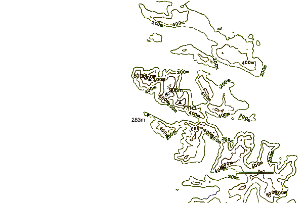
| Contours: | Roads & Rivers: | Select a
tide station / surf break / city |

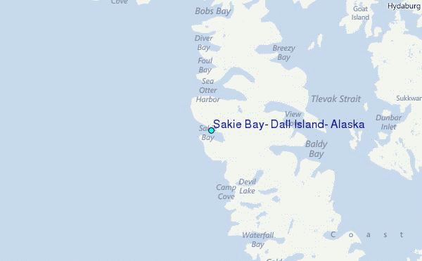
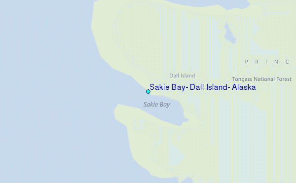
Use this relief map to navigate to tide stations, surf breaks and cities that are in the area of Sakie Bay, Dall Island, Alaska.
Other Nearby Locations' tide tables and tide charts to Sakie Bay, Dall Island, Alaska:
click location name for more details
 Surf breaks close to Sakie Bay, Dall Island, Alaska:
|
||
|---|---|---|
| Closest surf break | Lepus Beach (Haida-Gwaii) | 63 mi |
| Second closest surf break | Tow Hill Beach | 89 mi |
| Third closest surf break | Cannon Beach | 392 mi |
| Fourth closest surf break | Graveyards | 396 mi |
| Fifth closest surf break | Ocean Cape | 397 mi |


 Nearest
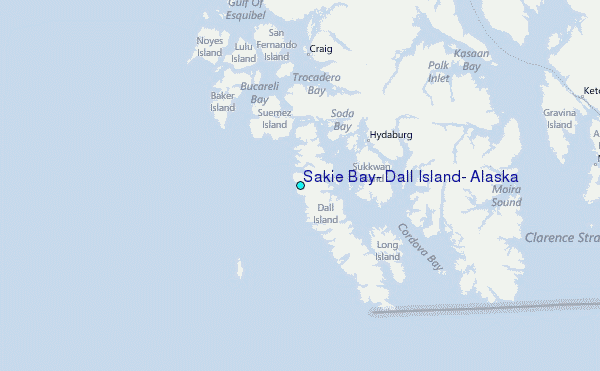