
| Distance / Altitude | Location | Report Date / Time | Live Weather | Wind | Gusts | Temp. | Visibility | Cloud |
|---|---|---|---|---|---|---|---|---|
| 4 km S / 120 m | Songkhla(thai-navy) (Thailand) | 2026-06-09 10:00 local (2026/06/09 03:00 GMT) | no report | light winds from the WSW (11 km/h at 240) | 33°C | - | - - - | |
| 27 km S / 10 m | Kho Hong Agromet (Thailand) | 2026-06-09 10:00 local (2026/06/09 03:00 GMT) | no report | light winds from the SW (11 km/h at 230) | 33°C | - | - - - | |
| 41 km SSW / 35 m | Hat Yai Airport (Thailand) | 2026-06-09 10:00 local (2026/06/09 03:00 GMT) | no report | light winds from the SW (7 km/h at 230) | 31°C | - | - - - | |
| 43 km SSW / 35 m | Hat Yai Airport (Thailand) | 2026-06-09 10:30 local (2026/06/09 03:30 GMT) | Dry and partly cloudy | light winds from the SW.(Wind varies from 200 to 260 degs) (9 km/h at 230) | 31°C | 10.0 | few scattered broken | |
| 54 km S / 25 m | Sadao (Thailand) | 2026-06-09 10:00 local (2026/06/09 03:00 GMT) | no report | light winds from the W (9 km/h at 260) | 31°C | - | - | |
| 54 km S / 25 m | Sadao Town (Thailand) | 2026-06-09 10:00 local (2026/06/09 03:00 GMT) | no report | light winds from the W (9 km/h at 260) | 31°C | - | - | |
| 63 km WNW / 4 m | Phatthalung Agromet (Thailand) | 2026-06-09 11:00 local (2026/06/09 04:00 GMT) | no report | calm (0 km/h at 320) | 30°C | - | - - - | |
| 77 km SE / 9 m | Pattani (Thailand) | 2026-06-09 10:00 local (2026/06/09 03:00 GMT) | no report | wind obs. (6 kph from 350 degs) was rejected (- km/h at -) | 31°C | - | - | |
| 87 km SSW / 6 m | Satun Thai Air Force Base (Thailand) | 2026-06-09 10:00 local (2026/06/09 03:00 GMT) | no report | light winds from the WNW (9 km/h at 290) | 31°C | - | - - - | |
| 92 km S / 22 m | Chuping (Malaysia) | 2026-06-09 11:00 local (2026/06/09 04:00 GMT) | haze | light winds from the W (11 km/h at 270) | 31°C | 15 | - |
| Contours: | Roads & Rivers: | Select a
tide station / surf break / city |
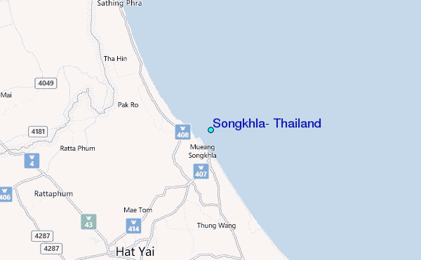
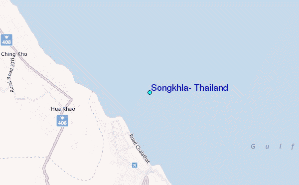
Use this relief map to navigate to tide stations, surf breaks and cities that are in the area of Songkhla, Thailand.
Other Nearby Locations' tide tables and tide charts to Songkhla, Thailand:
click location name for more details
 Surf breaks close to Songkhla, Thailand:
|
||
|---|---|---|
| Closest surf break | Songkhla - Fulerayem Point | 2 mi |
| Second closest surf break | Cenang Beach (The Cliff) | 89 mi |
| Third closest surf break | Tengah Beach (Bank Negara) | 89 mi |
| Fourth closest surf break | Koh Lanta - Khlong Dao | 112 mi |
| Fifth closest surf break | Ko Samui | 162 mi |


 Nearest
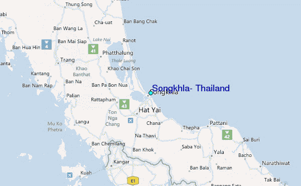