
| Distance / Altitude | Location | Report Date / Time | Live Weather | Wind | Gusts | Temp. | Visibility | Cloud |
|---|---|---|---|---|---|---|---|---|
| 13 km SW / 217 m | Southport Airport (North Carolina) | 2026-06-09 02:35 local (2026/06/09 06:35 GMT) | Dry and cloudy | light winds from the ENE (15 km/h at 60) | 23°C | 16 | overcast | |
| 14 km NE / 3 m | BUOY-MBIN7 (Marine) | 2026-06-09 03:00 local (2026/06/09 07:00 GMT) | light winds from the E (17 km/h at 80) | 23°C | - | |||
| 24 km NNE / 3 m | BUOY-MBNN7 (Marine) | 2026-06-09 03:00 local (2026/06/09 07:00 GMT) | light winds from the ENE (17 km/h at 70) | 23°C | - | |||
| 27 km N / 3 m | BUOY-WLON7 (Marine) | 2026-06-09 03:00 local (2026/06/09 07:00 GMT) | - (- km/h at -) | 22°C | - | |||
| 27 km NE / 3 m | Masonboro Inlet- ILM2- NC (Marine) | 2026-06-09 03:00 local (2026/06/09 07:00 GMT) | - (- km/h at -) | 23°C | - | |||
| 27 km NE / 3 m | BUOY-41038 (Marine) | 2026-06-09 03:08 local (2026/06/09 07:08 GMT) | fresh winds from the ENE (29 km/h at 70) | 23°C | - | |||
| 29 km NNE / 3 m | BUOY-JMPN7 (Marine) | 2026-06-09 03:00 local (2026/06/09 07:00 GMT) | fresh winds from the ENE (32 km/h at 60) | 22°C | - | |||
| 31 km N / 218 m | Wilmington Airport (North Carolina) | 2026-06-09 02:39 local (2026/06/09 06:39 GMT) | Dry and partly cloudy | light winds from the NNE (9 km/h at 30) | 20°C | 16 | broken | |
| 31 km S / 3 m | Wilmington Harbor- NC (Marine) | 2026-06-09 03:26 local (2026/06/09 07:26 GMT) | - (- km/h at -) | — | - | |||
| 51 km SW / 3 m | Sunset Beach Nearshore Buoy (Marine) | 2026-06-09 03:05 local (2026/06/09 07:05 GMT) | - (- km/h at -) | — | - |
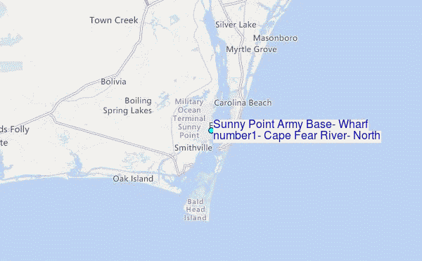
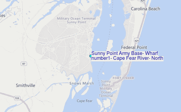
Choose Sunny Point Army Base, Wharf number1, Cape Fear River, North Carolina Location Map Zoom:
| Contours: | Roads & Rivers: | Select a
tide station / surf break / city |
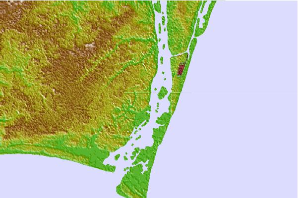

Use this relief map to navigate to tide stations, surf breaks and cities that are in the area of Sunny Point Army Base, Wharf number1, Cape Fear River, North Carolina.
Other Nearby Locations' tide tables and tide charts to Sunny Point Army Base, Wharf number1, Cape Fear River, North Carolina:
click location name for more details
 Surf breaks close to Sunny Point Army Base, Wharf number1, Cape Fear River, North Carolina:
|
||
|---|---|---|
| Closest surf break | Shit Pipe | 4 mi |
| Second closest surf break | Beauregard | 4 mi |
| Third closest surf break | Pelican Watch | 5 mi |
| Fourth closest surf break | Fort Fisher | 6 mi |
| Fifth closest surf break | Long Beach | 9 mi |


 Nearest
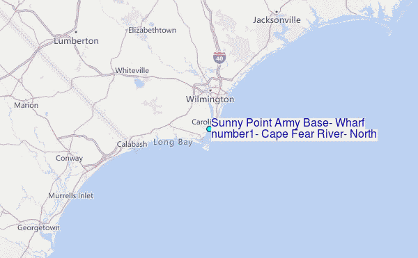