
| Distance / Altitude | Location | Report Date / Time | Live Weather | Wind | Gusts | Temp. | Visibility | Cloud |
|---|---|---|---|---|---|---|---|---|
| 13 km E / 6 m | BaccaroPt-NS (Canada) | 2026-06-09 01:00 local (2026/06/09 04:00 GMT) | no report | light winds from the W (18 km/h at 260) | 13°C | - | - no observation - | |
| 48 km WNW / 10 m | Tusket (Canada) | 2026-06-09 00:03 local (2026/06/09 03:03 GMT) | dry | calm (3 km/h at 272) | 13°C | - | - - 0 | |
| 57 km WNW / 36 m | YarmouthRcs-NS (Canada) | 2026-06-09 01:00 local (2026/06/09 04:00 GMT) | no report | wind obs. (11 kph from 250 degs) was rejected (- km/h at -) | 16°C | - | - no observation - | |
| 57 km WNW / 43 m | Yarmouth Airport (Nova scotia) | 2026-06-09 00:00 local (2026/06/09 03:00 GMT) | Dry and cloudy | light winds from the WNW (13 km/h at 290) | 13°C | 24 | overcast broken broken | |
| 61 km WNW / 9 m | Yarmouth Ua- NS (Canada) | 2026-06-09 00:19 local (2026/06/09 03:19 GMT) | no report | - (- km/h at -) | 16°C | - | - | |
| 75 km NW / 16 m | Port Maitland (Canada) | 2026-06-09 01:44 local (2026/06/09 04:44 GMT) | dry | light winds from the SSW (6 km/h at 208) | 10°C | - | - - 0 | |
| 75 km NW / 7 m | Port Maitland wx (Canada) | 2026-06-09 01:01 local (2026/06/09 04:01 GMT) | dry | light winds from the SSW (6 km/h at 211) | 10°C | - | - - 0 | |
| 76 km NW / 45 m | Cedar Lake (Canada) | 2026-06-09 01:22 local (2026/06/09 04:22 GMT) | dry | calm (2 km/h at 263) | 12°C | - | - - 0 | |
| 84 km NE / 61 m | Port Mouton wx (Canada) | 2026-06-09 00:47 local (2026/06/09 03:47 GMT) | dry | calm (0 km/h at 0) | 7°C | - | - - 0 | |
| 98 km NE / 217 m | Western Head Airport (Nova Scotia) | 2026-06-09 00:00 local (2026/06/09 03:00 GMT) | - | light winds from the W (13 km/h at 260) | 10°C | 0.0 |
| Contours: | Roads & Rivers: | Select a
tide station / surf break / city |
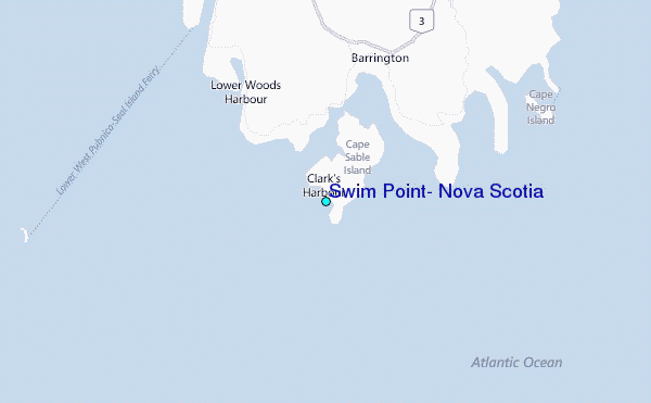
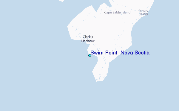
Use this relief map to navigate to tide stations, surf breaks and cities that are in the area of Swim Point, Nova Scotia.
Other Nearby Locations' tide tables and tide charts to Swim Point, Nova Scotia:
click location name for more details
 Surf breaks close to Swim Point, Nova Scotia:
|
||
|---|---|---|
| Closest surf break | Summerville | 53 mi |
| Second closest surf break | White Point Beach | 58 mi |
| Third closest surf break | Scotts Bay | 60 mi |
| Fourth closest surf break | Western Head Reef | 61 mi |
| Fifth closest surf break | Western Head Point | 62 mi |


 Nearest
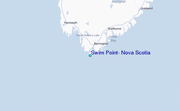