
| Distance / Altitude | Location | Report Date / Time | Live Weather | Wind | Gusts | Temp. | Visibility | Cloud |
|---|---|---|---|---|---|---|---|---|
| 27 km E / 0 m | Darwin Ntc Aws (Australia) | 2026-06-09 14:30 local (2026/06/09 05:00 GMT) | no report | - (- km/h at -) | — | - | - | |
| 30 km E / 218 m | Darwin Airport (Australia) | 2026-06-09 14:00 local (2026/06/09 04:30 GMT) | Dry and partly cloudy | light winds from the E (13 km/h at 90) | 32°C | 10.0 | scattered | |
| 32 km E / 35 m | Darwin Airport (Australia) | 2026-06-09 14:30 local (2026/06/09 05:00 GMT) | Dry and partly cloudy | light winds from the E (13 km/h at 90) | 32°C | 10.0 | scattered overcast broken | |
| 32 km SSW / 4 m | DumINMirrie Aws (Australia) | 2026-06-09 14:30 local (2026/06/09 05:00 GMT) | - | light winds from the ENE (7 km/h at 60) | 32°C | - | - no observation - | |
| 33 km E / 1 m | Marrara wx (Australia) | 2026-06-09 15:09 local (2026/06/09 05:39 GMT) | dry | calm (0 km/h at 227) | 31°C | - | - - 0 | |
| 47 km SE / 94 m | KangarooFlats(Defence) (Australia) | 2026-06-09 14:30 local (2026/06/09 05:00 GMT) | no report | calm (2 km/h at 30) | 28°C | - | - no observation - | |
| 52 km ESE / 19 m | NoonamahAirstrip (Australia) | 2026-06-09 14:30 local (2026/06/09 05:00 GMT) | no report | light winds from the ESE (9 km/h at 110) | 25°C | - | - no observation - | |
| 62 km E / 62 m | Herbert (Australia) | 2026-06-09 13:45 local (2026/06/09 04:15 GMT) | dry | calm (2 km/h at 279) | 32°C | - | - - 0 | |
| 78 km ESE / 235 m | Middle Point Automatic Weather Station (Australia) | 2026-06-09 14:30 local (2026/06/09 05:00 GMT) | - | light winds from the SE (7 km/h at 130) | 32°C | - | no observation | |
| 81 km SE / 105 m | BatchelorAero (Australia) | 2026-06-09 14:30 local (2026/06/09 05:00 GMT) | no report | calm (4 km/h at 80) | 24°C | - | - no observation - |
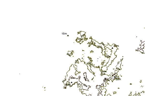
| Contours: | Roads & Rivers: | Select a
tide station / surf break / city |

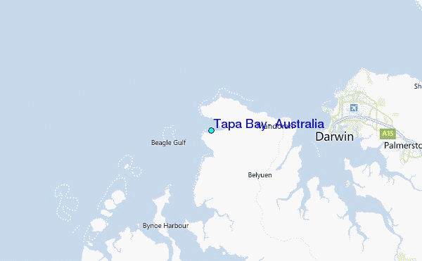
Use this relief map to navigate to tide stations, surf breaks and cities that are in the area of Tapa Bay, Australia.
Other Nearby Locations' tide tables and tide charts to Tapa Bay, Australia:
click location name for more details
 Surf breaks close to Tapa Bay, Australia:
|
||
|---|---|---|
| Closest surf break | Fannie Bay | 16 mi |
| Second closest surf break | Rapid Creek - Bar | 18 mi |
| Third closest surf break | Rapid Creek - Reef | 18 mi |
| Fourth closest surf break | Rapid Creek - Beach | 19 mi |
| Fifth closest surf break | Casuarina (Darwin) | 22 mi |


 Nearest