
| Distance / Altitude | Location | Report Date / Time | Live Weather | Wind | Gusts | Temp. | Visibility | Cloud |
|---|---|---|---|---|---|---|---|---|
| 62 km NE / 0 m | lightning 205km N of Ishigaki (Japan) | 2026-06-09 21:51 local (2026/06/09 12:51 GMT) | Thunderstorm | (- km/h at -) | — | |||
| 77 km NE / 0 m | lightning 200km NW of Hirara (Japan) | 2026-06-09 21:51 local (2026/06/09 12:51 GMT) | Thunderstorm | (- km/h at -) | — | |||
| 103 km NW / 0 m | lightning 208km NNE of Keelung (Taiwan) | 2026-06-09 21:46 local (2026/06/09 12:46 GMT) | Thunderstorm | (- km/h at -) | — | |||
| 141 km WSW / 102 m | Pengjia YU (China) | 2026-06-09 21:20 local (2026/06/09 12:20 GMT) | no report | wind obs. (29 kph from 190 degs) was rejected (- km/h at -) | 29°C | 20 | - | |
| 149 km S / 17 m | Yonaguni Airport (Japan) | 2026-06-09 20:00 local (2026/06/09 11:00 GMT) | Mist - | fresh winds from the NE (35 km/h at 50) | 26°C | 5.0 | scattered broken broken | |
| 149 km S / 0 m | lightning 14km E of Yonakuni (Japan) | 2026-06-09 20:34 local (2026/06/09 11:34 GMT) | Thunderstorm | (- km/h at -) | — | |||
| 156 km SSE / 77 m | Akaishi (Japan) | 2026-06-09 21:00 local (2026/06/09 12:00 GMT) | - | light winds from the NNE (13 km/h at 31) | 25°C | - | - - 0 | |
| 170 km SSE / 15 m | Ishigakijima (Japan) | 2026-06-09 20:00 local (2026/06/09 11:00 GMT) | Shower heavy rain shower | light winds from the WSW (19 km/h at 240) | — | 2.0 | few few scattered | |
| 174 km SE / 9 m | Tarama Island (Japan) | 2026-06-09 20:00 local (2026/06/09 11:00 GMT) | Dry and partly cloudy | moderate winds from the SW (20 km/h at 230) | — | 10.0 | few scattered broken | |
| 187 km SW / 74 m | Tianliaogang wx (Taiwan) | 2026-06-09 21:46 local (2026/06/09 12:46 GMT) | - | calm (0 km/h at 0) | 23°C | - | - - 0 |
| Contours: | Roads & Rivers: | Select a
tide station / surf break / city |
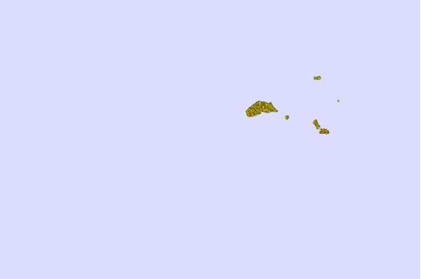
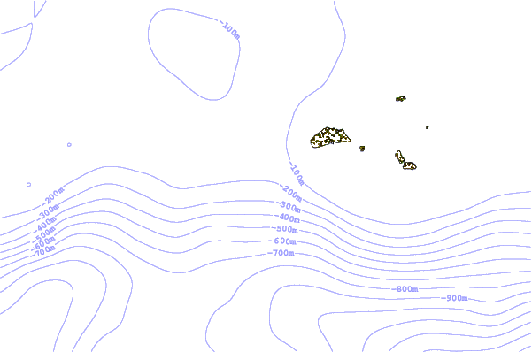
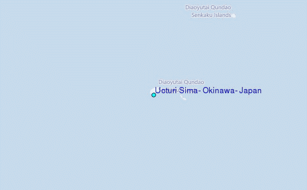
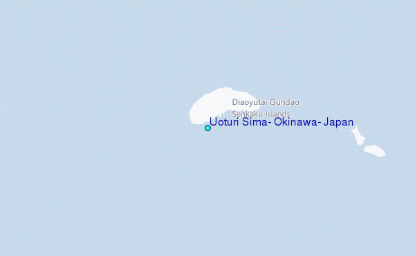
Use this relief map to navigate to tide stations, surf breaks and cities that are in the area of Uoturi Sima, Okinawa, Japan.
Other Nearby Locations' tide tables and tide charts to Uoturi Sima, Okinawa, Japan:
click location name for more details
 Surf breaks close to Uoturi Sima, Okinawa, Japan:
|
||
|---|---|---|
| Closest surf break | Fulung Beach | 108 mi |
| Second closest surf break | Lightning Bolt | 114 mi |
| Third closest surf break | Green Bay | 119 mi |
| Fourth closest surf break | Barrels | 121 mi |
| Fifth closest surf break | The Core | 124 mi |


 Nearest