
| Distance / Altitude | Location | Report Date / Time | Live Weather | Wind | Gusts | Temp. | Visibility | Cloud |
|---|---|---|---|---|---|---|---|---|
| 11 km W / 215 m | Le Raizet Airport (Lesser Antilles) | 2024-04-23 08:30 local (2024/04/23 12:30 GMT) | Dry and partly cloudy | light winds from the E.(Wind varies from 060 to 120 degs) (13 km/h at 90) | 28°C | 10.0 | few broken | |
| 11 km NNE / 22 m | Blanchet wx (Guadeloupe) | 2024-04-23 08:38 local (2024/04/23 12:38 GMT) | - | wind obs. (6 kph from 36 degs) was rejected (- km/h at -) | 28°C | - | - - 0 | |
| 81 km SSE / 339 m | Melville Hall AR Airport (Dominican Republic) | 2024-04-23 07:00 local (2024/04/23 11:00 GMT) | Dry and partly cloudy | light winds from the ESE (13 km/h at 120) | 28°C | 10.0 | broken | |
| 102 km WNW / 168 m | John Osborne Airport (Montserrat) | 2024-04-23 08:00 local (2024/04/23 12:00 GMT) | - | moderate winds from the E.(Wind varies from 050 to 130 degs) (22 km/h at 100) | 28°C | 10.0 | few | |
| 103 km NW / 6 m | Renfrew (Antigua and Barbuda) | 2024-04-23 07:14 local (2024/04/23 11:14 GMT) | dry | wind obs. (8 kph from 188 degs) was rejected (- km/h at -) | 28°C | - | - - 0 |
| Contours: | Roads & Rivers: | Select a
tide station / surf break / city |
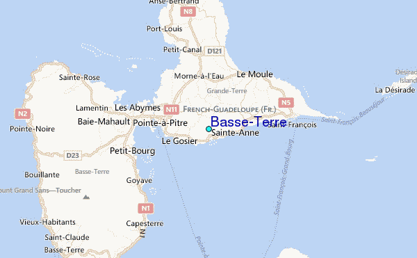
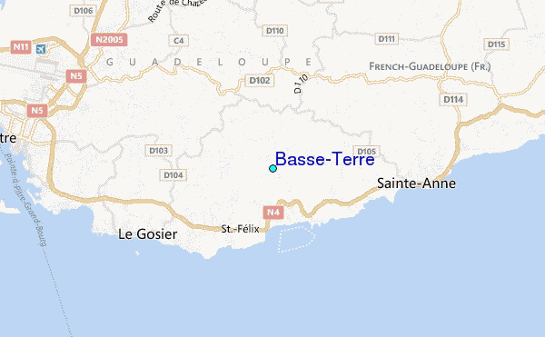
Use this relief map to navigate to tide stations, surf breaks and cities that are in the area of Basse-Terre.
Other Nearby Locations' tide tables and tide charts to Basse-Terre:
click location name for more details
 Surf breaks close to Basse-Terre:
|
||
|---|---|---|
| Closest surf break | Petit Havre | 1 mi |
| Second closest surf break | Caravelle | 3 mi |
| Third closest surf break | Hotel Novotel | 5 mi |
| Fourth closest surf break | La Caravelle | 5 mi |
| Fifth closest surf break | Anse A La Barque | 8 mi |

 Nearest
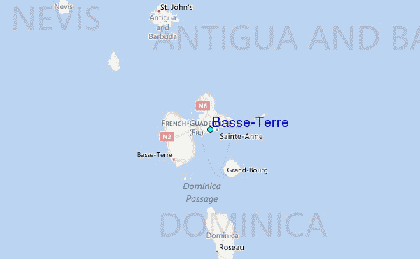