
| Distance / Altitude | Location | Report Date / Time | Live Weather | Wind | Gusts | Temp. | Visibility | Cloud |
|---|---|---|---|---|---|---|---|---|
| 70 km ESE / 32 m | Bay Roberts (Newfoundland) | 2024-04-16 15:49 local (2024/04/16 18:19 GMT) | dry | calm (0 km/h at 260) | 11°C | - | - - 0 | |
| 77 km ESE / 52 m | The Battery wx (Canada) | 2024-04-16 15:39 local (2024/04/16 18:09 GMT) | dry | light winds from the WSW (10 km/h at 248) | 11°C | - | - - 0 | |
| 81 km E / 20 m | Gussetts Cove wx (Canada) | 2024-04-16 15:07 local (2024/04/16 17:37 GMT) | dry | calm (0 km/h at 141) | 6°C | - | - - 0 | |
| 91 km ESE / 85 m | Holyrood (Canada) | 2024-04-16 15:03 local (2024/04/16 17:33 GMT) | dry | calm (2 km/h at 204) | 18°C | - | - - 0 | |
| 99 km ESE / 116 m | St. Phillips (Canada) | 2024-04-16 14:55 local (2024/04/16 17:25 GMT) | dry | calm (3 km/h at 321) | 9°C | - | - - 0 |
| Contours: | Roads & Rivers: | Select a
tide station / surf break / city |
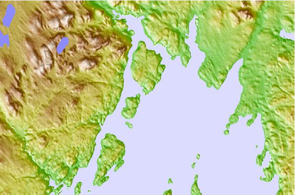
Use this relief map to navigate to tide stations, surf breaks and cities that are in the area of Woody Island, Newfoundland.
Other Nearby Locations' tide tables and tide charts to Woody Island, Newfoundland:
click location name for more details
 Surf breaks close to Woody Island, Newfoundland:
|
||
|---|---|---|
| Closest surf break | Ingonish Beach | 303 mi |
| Second closest surf break | Kennington Cove | 308 mi |
| Third closest surf break | Michaud Point | 345 mi |
| Fourth closest surf break | Martinique | 480 mi |
| Fifth closest surf break | Lawrencetown Left Point | 489 mi |

 Nearest