
| Distance / Altitude | Location | Report Date / Time | Live Weather | Wind | Gusts | Temp. | Visibility | Cloud |
|---|---|---|---|---|---|---|---|---|
| 2 km WSW / 5 m | Sittwe (Myanmar) | 2025-12-25 02:30 local (2025/12/24 20:00 GMT) | - | wind obs. (6 kph from 320 degs) was rejected (- km/h at -) | — | 6 | - scattered - | |
| 102 km WNW / 6 m | Teknaf (Bangladesh) | 2025-12-25 02:30 local (2025/12/24 20:00 GMT) | - | calm (4 km/h at 170) | — | 6 | - - - | |
| 105 km SE / 5 m | Kyaukpyu Ramree Island (Myanmar) | 2025-12-25 02:30 local (2025/12/24 20:00 GMT) | state of sky unchanged | wind obs. (17 kph from 230 degs) was rejected (- km/h at -) | 29°C | 6 | - | |
| 105 km SE / 5 m | Kyaukpyu-Ramree Island (Myanmar) | 2025-12-25 01:30 local (2025/12/24 19:00 GMT) | state of sky unchanged | wind obs. (17 kph from 230 degs) was rejected (- km/h at -) | 29°C | 6 | - - - | |
| 174 km WNW / 4 m | Cox's Bazar (Bangladesh) | 2025-12-25 02:30 local (2025/12/24 20:00 GMT) | - | light winds from the NNE (11 km/h at 30) | — | 3000 | - clear - | |
| 207 km E / 51 m | Minbu (Myanmar) | 2025-12-25 02:30 local (2025/12/24 20:00 GMT) | - | calm (2 km/h at 40) | — | 7 | - - - | |
| 216 km NW / 7 m | Kutubdia (Bangladesh) | 2025-12-25 02:30 local (2025/12/24 20:00 GMT) | - | wind obs. (9 kph from 170 degs) was rejected (- km/h at -) | — | 5 | - - - | |
| 239 km SE / 11 m | Thandwe (Myanmar) | 2025-12-25 02:30 local (2025/12/24 20:00 GMT) | intermittent light drizzle | calm (4 km/h at 130) | 27°C | 8 | - | |
| 241 km ENE / 55 m | Nyaung -U (Myanmar) | 2025-12-25 02:30 local (2025/12/24 20:00 GMT) | - | wind obs. (6 kph from 180 degs) was rejected (- km/h at -) | — | 9 | - few - | |
| 262 km NW / 6 m | Chittagong (Bangladesh) | 2025-12-25 02:30 local (2025/12/24 20:00 GMT) | - | wind obs. (13 kph from 210 degs) was rejected (- km/h at -) | — | 7 | - |

| Contours: | Roads & Rivers: | Select a
tide station / surf break / city |
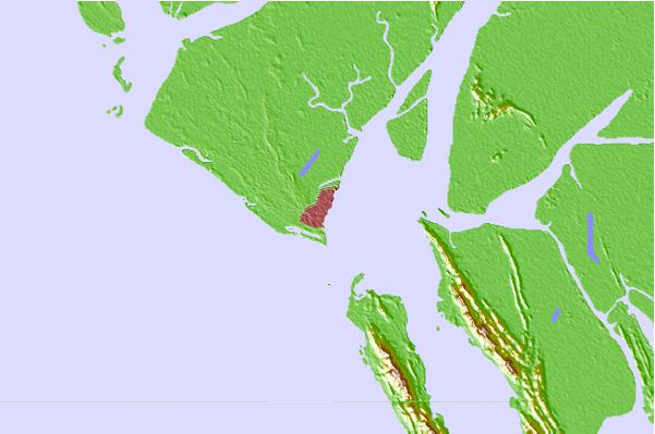
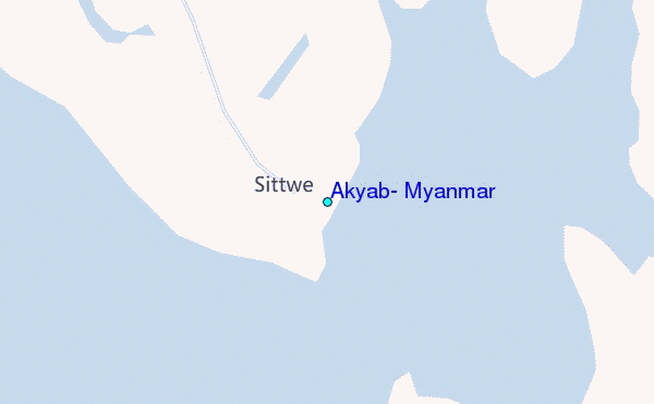
Use this relief map to navigate to tide stations, surf breaks and cities that are in the area of Akyab, Myanmar.
Other Nearby Locations' tide tables and tide charts to Akyab, Myanmar:
click location name for more details
 Surf breaks close to Akyab, Myanmar:
|
||
|---|---|---|
| Closest surf break | Cox's Bazar | 106 mi |
| Second closest surf break | Puri Beach | 461 mi |
| Third closest surf break | Butlers Bay (South Andaman) | 583 mi |
| Fourth closest surf break | Corbyns Cove (South Andaman) | 588 mi |
| Fifth closest surf break | Sentinel (South Andaman) | 592 mi |


 Nearest
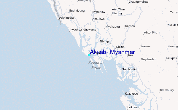