
| Distance / Altitude | Location | Report Date / Time | Live Weather | Wind | Gusts | Temp. | Visibility | Cloud |
|---|---|---|---|---|---|---|---|---|
| 59 km WNW / 15 m | SHIP5703 (Marine) | 2026-03-13 01:00 local (2026/03/13 07:00 GMT) | moderate winds from the N (24.12 km/h at 10) | — | - km | |||
| 59 km WNW / 15 m | SHIP7902 (Marine) | 2026-03-13 02:00 local (2026/03/13 08:00 GMT) | light winds from the NE (9.360000000000001 km/h at 40) | — | - km | |||
| 59 km WNW / 3 m | SHIP2963 (Marine) | 2026-03-13 02:00 local (2026/03/13 08:00 GMT) | moderate winds from the N (21 km/h at 360) | — | - | |||
| 59 km WNW / 3 m | SHIP2728 (Marine) | 2026-03-13 01:00 local (2026/03/13 07:00 GMT) | moderate winds from the NNE (24 km/h at 20) | — | - | |||
| 59 km WNW / 3 m | SHIP9395 (Marine) | 2026-03-13 01:00 local (2026/03/13 07:00 GMT) | moderate winds from the NNE (24 km/h at 20) | — | - | |||
| 59 km WNW / 15 m | SHIP4255 (Marine) | 2026-03-13 01:00 local (2026/03/13 07:00 GMT) | moderate winds from the NNE (24.12 km/h at 20) | — | - km | |||
| 59 km WNW / 3 m | SHIP8025 (Marine) | 2026-03-13 01:00 local (2026/03/13 07:00 GMT) | moderate winds from the NNE (24 km/h at 20) | — | - | |||
| 59 km WNW / 3 m | SHIP7373 (Marine) | 2026-03-13 01:00 local (2026/03/13 07:00 GMT) | moderate winds from the NNE (24 km/h at 20) | — | - | |||
| 59 km WNW / 15 m | SHIP9364 (Marine) | 2026-03-13 01:00 local (2026/03/13 07:00 GMT) | moderate winds from the NNE (24.12 km/h at 20) | — | - km | |||
| 59 km WNW / 15 m | SHIP8256 (Marine) | 2026-03-13 01:00 local (2026/03/13 07:00 GMT) | moderate winds from the NNE (24.12 km/h at 20) | — | - km |
| Contours: | Roads & Rivers: | Select a
tide station / surf break / city |
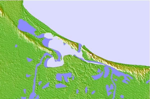
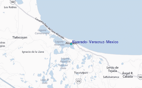
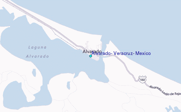
Use this relief map to navigate to tide stations, surf breaks and cities that are in the area of Alvarado, Veracruz, Mexico.
Other Nearby Locations' tide tables and tide charts to Alvarado, Veracruz, Mexico:
click location name for more details
 Surf breaks close to Alvarado, Veracruz, Mexico:
|
||
|---|---|---|
| Closest surf break | Punta Conejo | 184 mi |
| Second closest surf break | Salina Cruz | 184 mi |
| Third closest surf break | Punta Guetaguichi | 187 mi |
| Fourth closest surf break | Punta Chipehua | 193 mi |
| Fifth closest surf break | Bahia Grande | 198 mi |


 Nearest