
| Distance / Altitude | Location | Report Date / Time | Live Weather | Wind | Gusts | Temp. | Visibility | Cloud |
|---|---|---|---|---|---|---|---|---|
| 3 km S / 6 m | Neptune Beach wx (United States) | 2026-06-09 16:39 local (2026/06/09 20:39 GMT) | dry | calm (0 km/h at 93) | 29°C | - | - - 0 | |
| 6 km NW / 217 m | Mayport Naval Air Station Airport (Florida) | 2026-06-09 15:52 local (2026/06/09 19:52 GMT) | Dry and partly cloudy | moderate winds from the E (20 km/h at 100) | 29°C | 16 | scattered broken | |
| 6 km WSW / 15 m | Greenfield wx (United States) | 2026-06-09 17:09 local (2026/06/09 21:09 GMT) | dry | calm (5 km/h at 59) | 28°C | - | - - 0 | |
| 7 km WNW / 3 m | BUOY-LTJF1 (Marine) | 2026-06-09 16:30 local (2026/06/09 20:30 GMT) | - (- km/h at -) | 27°C | - | |||
| 8 km NW / 3 m | BUOY-MYPF1 (Marine) | 2026-06-09 16:30 local (2026/06/09 20:30 GMT) | light winds from the ENE (18 km/h at 70) | 27°C | - | |||
| 9 km SSW / 10 m | Isle of Palms South wx (United States) | 2026-06-09 17:17 local (2026/06/09 21:17 GMT) | dry | light winds from the ESE (11 km/h at 111) | 28°C | - | - - 0 | |
| 10 km SSW / 10 m | Jacksonville (Florida) | 2026-06-09 17:11 local (2026/06/09 21:11 GMT) | dry | calm (5 km/h at 248) | 28°C | - | - - 0 | |
| 11 km SW / 3 m | SHIP6209 (Marine) | 2026-06-09 15:00 local (2026/06/09 19:00 GMT) | - (- km/h at -) | 31°C | - | |||
| 11 km SW / 3 m | SHIP9538 (Marine) | 2026-06-09 17:00 local (2026/06/09 21:00 GMT) | - (- km/h at -) | 29°C | - | |||
| 11 km SW / 3 m | SHIP9370 (Marine) | 2026-06-09 17:00 local (2026/06/09 21:00 GMT) | - (- km/h at -) | 29°C | - |
| Contours: | Roads & Rivers: | Select a
tide station / surf break / city |
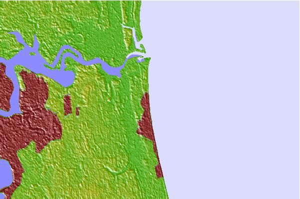

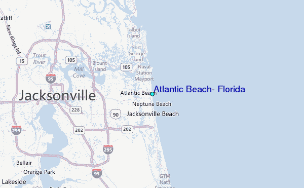
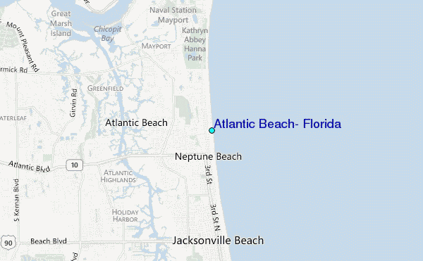
Use this relief map to navigate to tide stations, surf breaks and cities that are in the area of Atlantic Beach, Florida.
Other Nearby Locations' tide tables and tide charts to Atlantic Beach, Florida:
click location name for more details
 Surf breaks close to Atlantic Beach, Florida:
|
||
|---|---|---|
| Closest surf break | Jax Beach Pier | 1 mi |
| Second closest surf break | 7th Avenue | 2 mi |
| Third closest surf break | Hanna Park/Mayport Poles | 3 mi |
| Fourth closest surf break | The Barge | 3 mi |
| Fifth closest surf break | The Mayport Poles | 3 mi |


 Nearest
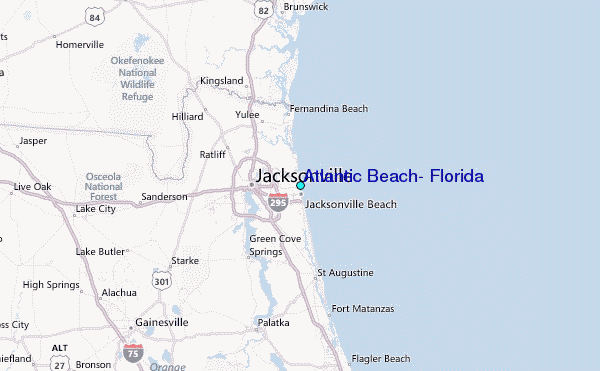