
| Distance / Altitude | Location | Report Date / Time | Live Weather | Wind | Gusts | Temp. | Visibility | Cloud |
|---|---|---|---|---|---|---|---|---|
| 11 km ESE / 21 m | BandaAcehBlangBintang (Indonesia) | 2025-12-24 06:30 local (2025/12/23 23:30 GMT) | Heavy rain | light winds from the SE.(Wind varies from 090 to 190 degs) (9 km/h at 140) | 24°C | 4.0 | few scattered - | |
| 154 km W / 15 m | SHIP3402 (Marine) | 2025-12-24 07:00 local (2025/12/24 00:00 GMT) | - (- km/h at -) | — | - km | |||
| 428 km NE / 3 m | Phuket (Thailand) | 2025-12-24 07:00 local (2025/12/24 00:00 GMT) | no report | wind obs. (11 kph from 280 degs) was rejected (- km/h at -) | 29°C | - | - no observation - | |
| 432 km ESE / 215 m | Medan/Polonia Airport (Indonesia) | 2025-12-24 06:30 local (2025/12/23 23:30 GMT) | Fog - | light winds from the SW (6 km/h at 230) | 24°C | 0.0 | few | |
| 437 km NE / 207 m | Phuket International Airport (Thailand) | 2025-12-24 06:30 local (2025/12/23 23:30 GMT) | - | calm (4 km/h at 1) | 22°C | 10.0 | few | |
| 431 km ESE / 215 m | Medan/Polonia Airport (Indonesia) | 2025-12-24 06:30 local (2025/12/23 23:30 GMT) | Fog - | light winds from the SW (6 km/h at 230) | 24°C | 0.0 | few | |
| 436 km NE / 207 m | Phuket International Airport (Thailand) | 2025-12-24 06:30 local (2025/12/23 23:30 GMT) | - | calm (4 km/h at 1) | 22°C | 10.0 | few | |
| 438 km NE / 9 m | PhuketAirport (Thailand) | 2025-12-24 07:00 local (2025/12/24 00:00 GMT) | no report | wind obs. (9 kph from 300 degs) was rejected (- km/h at -) | 29°C | - | - no observation - | |
| 467 km ENE / 7 m | KOLanta (Thailand) | 2025-12-24 07:00 local (2025/12/24 00:00 GMT) | no report | wind obs. (17 kph from 300 degs) was rejected (- km/h at -) | 29°C | 30 km | - mostly cloudy - | |
| 474 km NE / 8 m | Takya Pa (Thailand) | 2025-12-24 07:00 local (2025/12/24 00:00 GMT) | no report | wind obs. (6 kph from 310 degs) was rejected (- km/h at -) | 28°C | - | - no observation - |
| Contours: | Roads & Rivers: | Select a
tide station / surf break / city |
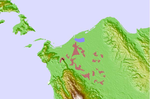
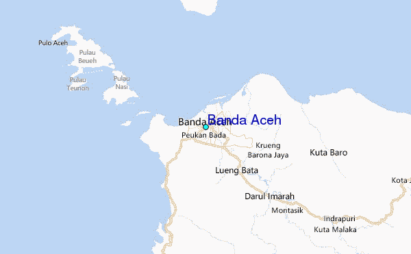
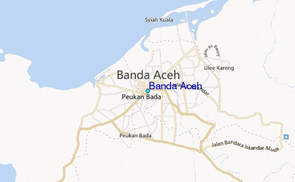
Use this relief map to navigate to tide stations, surf breaks and cities that are in the area of Banda Aceh.
Other Nearby Locations' tide tables and tide charts to Banda Aceh:
click location name for more details
 Surf breaks close to Banda Aceh:
|
||
|---|---|---|
| Closest surf break | Jackals | 223 mi |
| Second closest surf break | Teupah | 230 mi |
| Third closest surf break | Thailand | 231 mi |
| Fourth closest surf break | Teabags | 231 mi |
| Fifth closest surf break | Nai Harn Beach | 256 mi |


 Nearest