
| Distance / Altitude | Location | Report Date / Time | Live Weather | Wind | Gusts | Temp. | Visibility | Cloud |
|---|---|---|---|---|---|---|---|---|
| 11 km WNW / 41 m | Dix Hills (New York) | 2026-03-16 21:31 local (2026/03/17 01:31 GMT) | dry | light winds from the SSE (11 km/h at 147) | 12°C | - | - - 0 | |
| 15 km WSW / 218 m | Farmingdale Airport (New York) | 2026-03-16 20:08 local (2026/03/17 00:08 GMT) | Moderate rain | fresh winds from the S (35 km/h at 180) | 11°C | 10 | overcast | |
| 15 km NE / 218 m | Islip Airport (New York) | 2026-03-16 20:34 local (2026/03/17 00:34 GMT) | Light rain | fresh winds from the S (33 km/h at 190) | 12°C | 10 | overcast | |
| 18 km WSW / 22 m | Farmingdale (New York) | 2026-03-16 21:37 local (2026/03/17 01:37 GMT) | dry | calm (3 km/h at 17) | 9°C | - | - - 0 | |
| 33 km ENE / 217 m | Shirley Airport (New York) | 2026-03-16 20:31 local (2026/03/17 00:31 GMT) | Mist - | strong winds from the S (41 km/h at 180) | 13°C | 5 | overcast | |
| 39 km SSE / 0 m | lightning 38km S of Great River (United States) | 2026-03-16 19:51 local (2026/03/16 23:51 GMT) | Thunderstorm | (- km/h at -) | — | |||
| 41 km SSE / 0 m | lightning 38km S of West Sayville (United States) | 2026-03-16 19:51 local (2026/03/16 23:51 GMT) | Thunderstorm | (- km/h at -) | — | |||
| 42 km SSE / 0 m | lightning 40km S of Bayport (United States) | 2026-03-16 19:51 local (2026/03/16 23:51 GMT) | Thunderstorm | (- km/h at -) | — | |||
| 45 km ENE / 25 m | thunderstorm affecting Eastport (United States) | 2026-03-16 20:18 local (2026/03/17 00:18 GMT) | Thunderstorm | (- km/h at -) | — | |||
| 46 km S / - m | SHIP610 (ocean) | 2026-03-16 21:00 local (2026/03/17 01:00 GMT) | - | strong winds from the S (47 km/h at 170) | 10°C | - | no observation |
| Contours: | Roads & Rivers: | Select a
tide station / surf break / city |
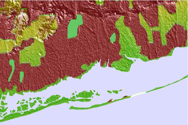
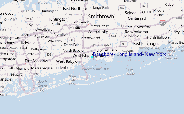
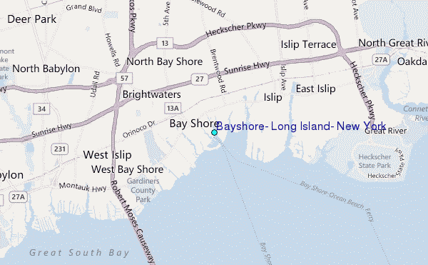
Use this relief map to navigate to tide stations, surf breaks and cities that are in the area of Bayshore, Long Island, New York.
Other Nearby Locations' tide tables and tide charts to Bayshore, Long Island, New York:
click location name for more details
 Surf breaks close to Bayshore, Long Island, New York:
|
||
|---|---|---|
| Closest surf break | Robert Moses State Park | 7 mi |
| Second closest surf break | Coastguards | 7 mi |
| Third closest surf break | Democrat Point Robert Moses | 7 mi |
| Fourth closest surf break | Point o Woods | 7 mi |
| Fifth closest surf break | Gilgo | 11 mi |


 Nearest
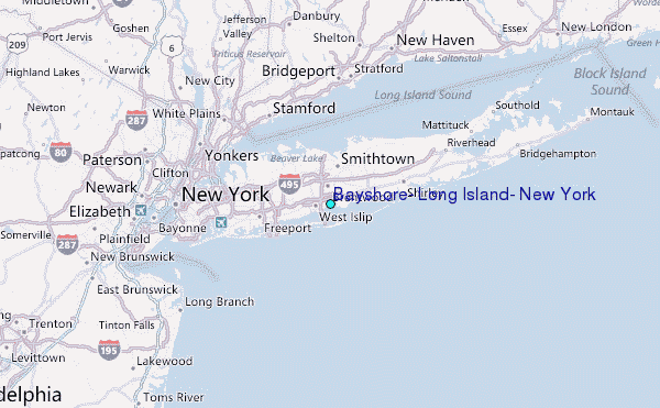