
| Distance / Altitude | Location | Report Date / Time | Live Weather | Wind | Gusts | Temp. | Visibility | Cloud |
|---|---|---|---|---|---|---|---|---|
| 9 km S / 2 m | BimaM.salahuddin (Indonesia) | 2024-04-26 20:00 local (2024/04/26 12:00 GMT) | - | light winds from the ESE (6 km/h at 120) | 29°C | 26 km | scattered | |
| 143 km WSW / 3 m | SumbawaBesarBrangbiji (Indonesia) | 2024-04-26 20:00 local (2024/04/26 12:00 GMT) | - | light winds from the SSE (9 km/h at 150) | 29°C | 28 km | few | |
| 192 km E / 1691 m | Ruteng Satar Tacik (Indonesia) | 2024-04-26 20:00 local (2024/04/26 12:00 GMT) | - | calm (4 km/h at 330) | 22°C | 26 km | mostly cloudy | |
| 219 km SE / 12 m | WaingapuMauHau (Indonesia) | 2024-04-26 20:00 local (2024/04/26 12:00 GMT) | - | calm (0 km/h at 0) | 28°C | 5.0 km | few | |
| 243 km SSE / 15 m | SHIP12337 (Marine) | 2024-04-26 19:00 local (2024/04/26 11:00 GMT) | gales from the ESE (63.0 km/h at 110) | 30°C | 17.7 km |
| Contours: | Roads & Rivers: | Select a
tide station / surf break / city |
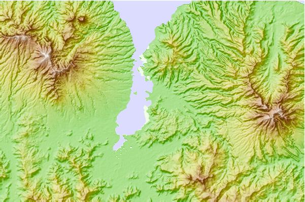
Use this relief map to navigate to tide stations, surf breaks and cities that are in the area of Bima.
Other Nearby Locations' tide tables and tide charts to Bima:
click location name for more details
 Surf breaks close to Bima:
|
||
|---|---|---|
| Closest surf break | Lakai Peak | 32 mi |
| Second closest surf break | Lakai Pipe | 32 mi |
| Third closest surf break | Nungas | 32 mi |
| Fourth closest surf break | Periscope Point | 32 mi |
| Fifth closest surf break | Bondo Kodi | 83 mi |

 Nearest