
| Distance / Altitude | Location | Report Date / Time | Live Weather | Wind | Gusts | Temp. | Visibility | Cloud |
|---|---|---|---|---|---|---|---|---|
| 169 km S / 3 m | Sepinggan Airport (Indonesia) | 2025-12-25 14:30 local (2025/12/25 06:30 GMT) | Dry and partly cloudy | light winds from the S.(Wind varies from 120 to 230 degs) (6 km/h at 180) | 31°C | 10.0 | few overcast - | |
| 215 km WNW / 995 m | lightning 216km NW of Bontang (Indonesia) | 2025-12-25 15:20 local (2025/12/25 07:20 GMT) | Thunderstorm | (- km/h at -) | — | |||
| 292 km ESE / 6 m | PaluMutiara (Indonesia) | 2025-12-25 14:00 local (2025/12/25 06:00 GMT) | - | moderate winds from the NNW (28 km/h at 340) | 32°C | 30 km | - mostly cloudy - | |
| 336 km SSE / 217 m | Majene (Indonesia (sulawesi)) | 2025-12-25 14:00 local (2025/12/25 06:00 GMT) | - | wind obs. (7 kph from 250 degs) was rejected (- km/h at -) | 32°C | 32 km | scattered | |
| 354 km N / 50 m | Juwata Airport (Indonesia) | 2025-12-25 14:30 local (2025/12/25 06:30 GMT) | Clouds dissolving | wind obs. (9 kph from 270 degs) was rejected (- km/h at -) | 32°C | 30 km | few mostly cloudy - | |
| 383 km ENE / 2 m | Toli-ToliLalos (Indonesia) | 2025-12-25 14:00 local (2025/12/25 06:00 GMT) | - | light winds from the NNW (7 km/h at 340) | 31°C | 31 km | mostly cloudy | |
| 391 km ESE / 2 m | PosoKasiguncu (Indonesia) | 2025-12-25 14:00 local (2025/12/25 06:00 GMT) | Precipitation within sight but not hitting ground | light winds from the N (7 km/h at 10) | 30°C | 27 km | - overcast - | |
| 458 km N / 130 m | Tawau (Malaysia) | 2025-12-25 14:00 local (2025/12/25 06:00 GMT) | Thunderstorms | light winds from the S (7 km/h at 170) | 30°C | 32 km | mostly cloudy | |
| 459 km N / 215 m | Tawau/Kalimantan Airport (Malaysia) | 2025-12-25 14:00 local (2025/12/25 06:00 GMT) | Dry and partly cloudy | wind obs. (7 kph from 170 degs) was rejected (- km/h at -) | 30°C | 10.0 | scattered | |
| 474 km SW / 27 m | PalangkaRayaTjilikRiwut (Indonesia) | 2025-12-25 14:00 local (2025/12/25 06:00 GMT) | - | wind obs. (6 kph from 330 degs) was rejected (- km/h at -) | 32°C | 30 km | - mostly cloudy - |
| Contours: | Roads & Rivers: | Select a
tide station / surf break / city |
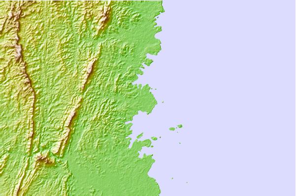
Use this relief map to navigate to tide stations, surf breaks and cities that are in the area of Bontang.
Other Nearby Locations' tide tables and tide charts to Bontang:
click location name for more details
 Surf breaks close to Bontang:
|
||
|---|---|---|
| Closest surf break | Tanjung Batu | 379 mi |
| Second closest surf break | Berakas Beach | 380 mi |
| Third closest surf break | Tungku Beach or KM26 | 380 mi |
| Fourth closest surf break | Tanjung Aru Beach | 413 mi |
| Fifth closest surf break | Pulau Manukan | 417 mi |


 Nearest