
| Distance / Altitude | Location | Report Date / Time | Live Weather | Wind | Gusts | Temp. | Visibility | Cloud |
|---|---|---|---|---|---|---|---|---|
| 2 km ESE / 2 m | Cap-haitien Airport (Haiti) | 2026-07-31 19:00 local (2026/07/31 23:00 GMT) | Dry and partly cloudy | moderate winds from the NE (24 km/h at 50) | 30°C | 8.0 | scattered broken | |
| 36 km SSW / 418 m | lightning 4km SSW of Plaisance (Haiti) | 2026-07-31 20:01 local (2026/08/01 00:01 GMT) | Thunderstorm | (- km/h at -) | — | |||
| 38 km SW / 295 m | thunderstorm affecting Pilate (Haiti) | 2026-07-31 20:01 local (2026/08/01 00:01 GMT) | Thunderstorm | (- km/h at -) | — | |||
| 52 km S / 384 m | lightning 17km ENE of Dessalines (Haiti) | 2026-07-31 20:16 local (2026/08/01 00:16 GMT) | Thunderstorm | (- km/h at -) | — | |||
| 68 km S / 600 m | lightning 16km N of Verrettes (Haiti) | 2026-07-31 20:01 local (2026/08/01 00:01 GMT) | Thunderstorm | (- km/h at -) | — | |||
| 94 km SW / 0 m | lightning 24km S of Anse Rouge (Haiti) | 2026-07-31 20:48 local (2026/08/01 00:48 GMT) | Thunderstorm | (- km/h at -) | — | |||
| 110 km S / 100 m | lightning 5km N of Cabaret (Haiti) | 2026-07-31 20:04 local (2026/08/01 00:04 GMT) | Thunderstorm | (- km/h at -) | — | |||
| 132 km S / 0 m | lightning 21km NNW of Leogane (Haiti) | 2026-07-31 20:50 local (2026/08/01 00:50 GMT) | Thunderstorm | (- km/h at -) | — | |||
| 132 km S / 256 m | Port-Au-prince Airport (Haiti) | 2026-07-31 19:00 local (2026/07/31 23:00 GMT) | Moderate rain | calm (4 km/h at 1) | 31°C | 5.0 | scattered broken | |
| 135 km S / 0 m | lightning 10km WNW of Gressier (Haiti) | 2026-07-31 20:45 local (2026/08/01 00:45 GMT) | Thunderstorm | (- km/h at -) | — |
| Contours: | Roads & Rivers: | Select a
tide station / surf break / city |
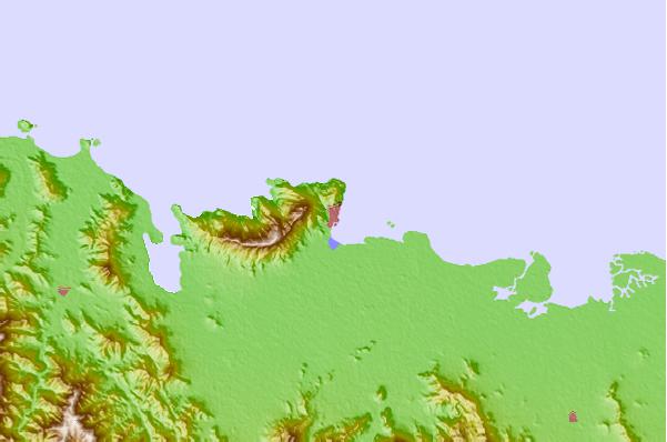
Use this relief map to navigate to tide stations, surf breaks and cities that are in the area of Cap Haitien.
Other Nearby Locations' tide tables and tide charts to Cap Haitien:
click location name for more details
 Surf breaks close to Cap Haitien:
|
||
|---|---|---|
| Closest surf break | Tea Break | 94 mi |
| Second closest surf break | Coffee Break | 98 mi |
| Third closest surf break | La Puntilla (Puerto Plata) | 98 mi |
| Fourth closest surf break | Jacmel | 109 mi |
| Fifth closest surf break | El Canal | 109 mi |


 Nearest