
| Distance / Altitude | Location | Report Date / Time | Live Weather | Wind | Gusts | Temp. | Visibility | Cloud |
|---|---|---|---|---|---|---|---|---|
| 9 km SE / 3 m | BUOY-WASD2 (Marine) | 2026-06-10 17:00 local (2026/06/10 21:00 GMT) | light winds from the NNW (8 km/h at 330) | 24°C | - | |||
| 9 km SE / 218 m | Washington/National Airport (Washington D.c.) | 2026-06-10 16:27 local (2026/06/10 20:27 GMT) | Light rain | moderate winds from the WNW (22 km/h at 300) | 25°C | 13 | broken broken overcast | |
| 17 km ENE / 15 m | College Park Airport (Maryland) (Maryland) | 2026-06-10 16:35 local (2026/06/10 20:35 GMT) | Light rain | light winds from the NW.(Wind varies from 280 to 350 degs) (13 km/h at 310) | 24°C | 16 | broken broken overcast | |
| 19 km NW / 134 m | thunderstorm affecting Rockville (United States) | 2026-06-10 15:46 local (2026/06/10 19:46 GMT) | Thunderstorm | (- km/h at -) | — | |||
| 20 km NNE / 128 m | thunderstorm affecting Colesville (United States) | 2026-06-10 16:18 local (2026/06/10 20:18 GMT) | Thunderstorm | (- km/h at -) | — | |||
| 21 km NNE / 126 m | thunderstorm affecting Cloverly (United States) | 2026-06-10 16:18 local (2026/06/10 20:18 GMT) | Thunderstorm | (- km/h at -) | — | |||
| 23 km S / 218 m | Fort Belvoir/Davison Airport (Virginia) | 2026-06-10 16:29 local (2026/06/10 20:29 GMT) | Thunderstorm - | moderate winds from the NW (22 km/h at 310) | — | 16 | ||
| 23 km ESE / 217 m | Andrews Air Force Base Airport (Maryland) | 2026-06-10 16:15 local (2026/06/10 20:15 GMT) | Thunderstorm - in the vicinity | moderate winds from the SW (24 km/h at 220) | 31°C | 16 | few scattered | |
| 24 km NW / 117 m | thunderstorm affecting North Potomac (United States) | 2026-06-10 15:17 local (2026/06/10 19:17 GMT) | Thunderstorm | (- km/h at -) | — | |||
| 26 km S / 29 m | lightning 7km SE of Newington (United States) | 2026-06-10 16:48 local (2026/06/10 20:48 GMT) | Thunderstorm | (- km/h at -) | — |
| Contours: | Roads & Rivers: | Select a
tide station / surf break / city |
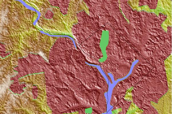
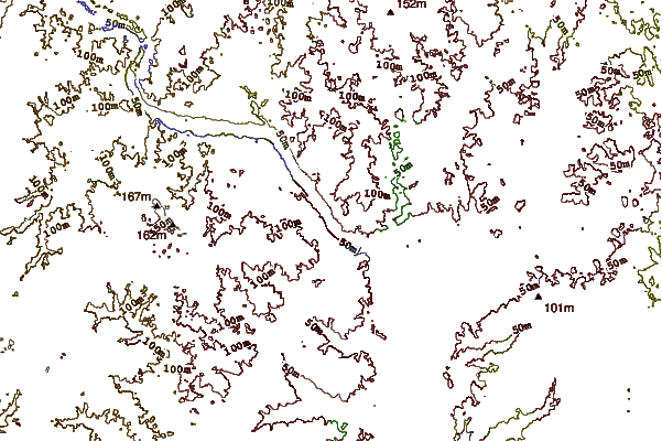
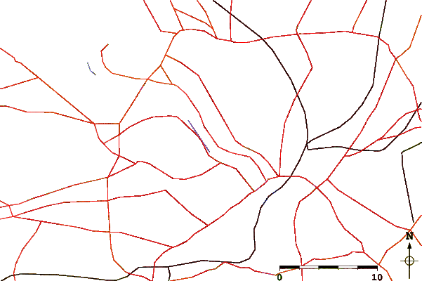
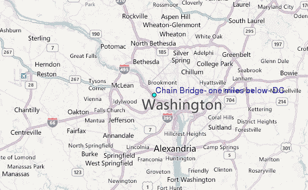
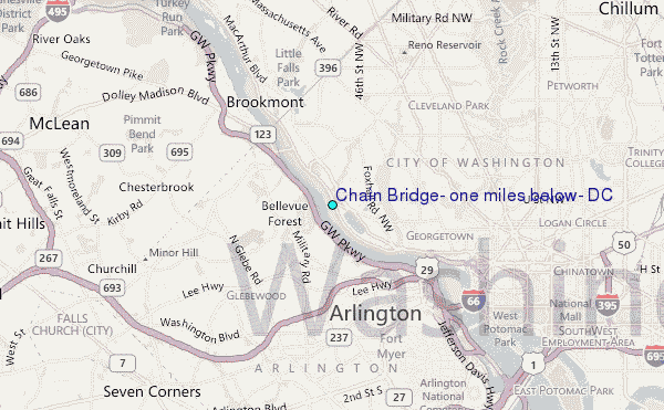
Use this relief map to navigate to tide stations, surf breaks and cities that are in the area of Chain Bridge, one miles below, DC.
Other Nearby Locations' tide tables and tide charts to Chain Bridge, one miles below, DC:
click location name for more details
 Surf breaks close to Chain Bridge, one miles below, DC:
|
||
|---|---|---|
| Closest surf break | Naval Jetties | 109 mi |
| Second closest surf break | The Cove Delaware | 109 mi |
| Third closest surf break | Dewey Beach | 110 mi |
| Fourth closest surf break | Rehoboth Main | 110 mi |
| Fifth closest surf break | Tower Road | 111 mi |


 Nearest
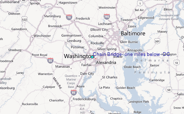