
| Distance / Altitude | Location | Report Date / Time | Live Weather | Wind | Gusts | Temp. | Visibility | Cloud |
|---|---|---|---|---|---|---|---|---|
| 59 km N / 72 m | Kénendé wx (Guinea) | 2026-06-09 20:35 local (2026/06/09 20:35 GMT) | dry | calm (0 km/h at 167) | 27°C | - | - - 0 | |
| 263 km NNE / 576 m | lightning 50km NW of Labe (Guinea) | 2026-06-09 21:16 local (2026/06/09 21:16 GMT) | Thunderstorm | (- km/h at -) | — | |||
| 337 km WNW / 397 m | Bissau Airport (Guinea-bissau) | 2026-06-09 20:00 local (2026/06/09 20:00 GMT) | Dry and partly cloudy | calm (4 km/h at 1) | 28°C | 9.0 | few - - | |
| 338 km WNW / 36 m | BissauAeroporto (Guinea-Bissau) | 2026-06-09 21:00 local (2026/06/09 21:00 GMT) | - | calm (4 km/h at 240) | 28°C | 28 km | scattered | |
| 367 km ESE / 328 m | lightning 39km SE of Seidu (Sierra Leone) | 2026-06-09 18:46 local (2026/06/09 18:46 GMT) | Thunderstorm | (- km/h at -) | — | |||
| 377 km NNE / 167 m | Kedougou Airport (Senegal) | 2026-06-09 21:00 local (2026/06/09 21:00 GMT) | Thunderstorm - in the vicinity | calm (4 km/h at 200) | 30°C | 10.0 | few | |
| 397 km NW / 10 m | Kolda Airport (Senegal) | 2026-06-09 21:00 local (2026/06/09 21:00 GMT) | - | calm (4 km/h at 180) | — | 0.0 | ||
| 438 km WNW / 482 m | Ziguinchor (Senegal) | 2026-06-09 20:00 local (2026/06/09 20:00 GMT) | - | light winds from the WNW (11 km/h at 300) | — | 0.0 | ||
| 438 km WNW / 482 m | Ziguinchor Airport (Senegal) | 2026-06-09 19:00 local (2026/06/09 19:00 GMT) | - | light winds from the NW (15 km/h at 320) | — | 0.0 | ||
| 461 km WNW / 407 m | Cape Skiring Airport (Senegal) | 2026-06-09 21:00 local (2026/06/09 21:00 GMT) | - | light winds from the NW (11 km/h at 320) | — | 0.0 |
| Contours: | Roads & Rivers: | Select a
tide station / surf break / city |
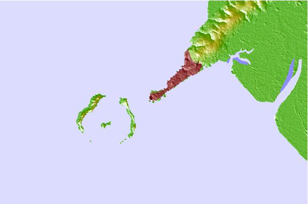
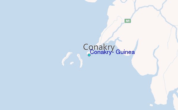
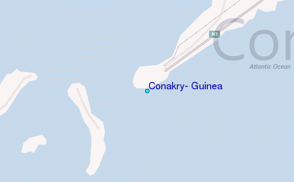
Use this relief map to navigate to tide stations, surf breaks and cities that are in the area of Conakry, Guinea.
Other Nearby Locations' tide tables and tide charts to Conakry, Guinea:
click location name for more details
 Surf breaks close to Conakry, Guinea:
|
||
|---|---|---|
| Closest surf break | Aberdeen Area Beach | 76 mi |
| Second closest surf break | River No. 2 | 88 mi |
| Third closest surf break | Burreh Beach | 97 mi |
| Fourth closest surf break | Baki (Turtle Islands) | 138 mi |
| Fifth closest surf break | Baki (Turtle Islands) | 140 mi |


 Nearest
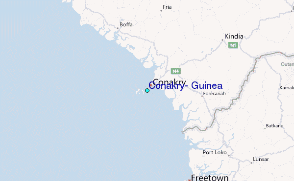