
| Distance / Altitude | Location | Report Date / Time | Live Weather | Wind | Gusts | Temp. | Visibility | Cloud |
|---|---|---|---|---|---|---|---|---|
| 3 km SSE / 9 m | Las Margaritas wx (Panama) | 2026-06-13 05:42 local (2026/06/13 10:42 GMT) | dry | light winds from the NE (8 km/h at 36) | 24°C | - | - - 0 | |
| 6 km N / 3 m | SHIP8067 (Marine) | 2026-06-13 06:00 local (2026/06/13 11:00 GMT) | - (- km/h at -) | 28°C | - | |||
| 48 km SE / 160 m | El Peñón wx (Panama) | 2026-06-13 06:01 local (2026/06/13 11:01 GMT) | - | - (- km/h at ) | 34°C | - | - - 0 | |
| 54 km SSE / 78 m | Mata de Coco wx (Panama) | 2026-06-13 05:06 local (2026/06/13 10:06 GMT) | - | - (- km/h at ) | 33°C | - | - - 0 | |
| 30 km NNE / 15 m | SHIP8378 (Marine) | 2026-06-13 05:00 local (2026/06/13 10:00 GMT) | - (- km/h at -) | — | - km | |||
| 30 km NNE / 3 m | SHIP4893 (Marine) | 2026-06-13 05:00 local (2026/06/13 10:00 GMT) | - (- km/h at -) | 28°C | - | |||
| 30 km NNE / 3 m | SHIP7256 (Marine) | 2026-06-13 05:00 local (2026/06/13 10:00 GMT) | - (- km/h at -) | 28°C | - | |||
| 45 km NNE / 3 m | SHIP5634 (Marine) | 2026-06-13 04:00 local (2026/06/13 09:00 GMT) | - (- km/h at -) | 28°C | - | |||
| 45 km NNE / 15 m | SHIP6959 (Marine) | 2026-06-13 04:00 local (2026/06/13 09:00 GMT) | - (- km/h at -) | — | - km | |||
| 45 km NNE / 15 m | SHIP8990 (Marine) | 2026-06-13 04:00 local (2026/06/13 09:00 GMT) | - (- km/h at -) | — | - km |
| Contours: | Roads & Rivers: | Select a
tide station / surf break / city |
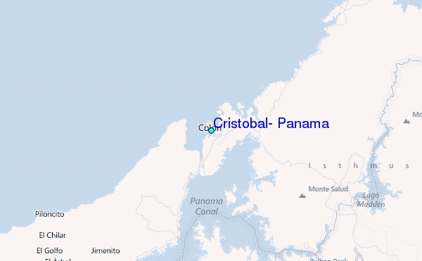
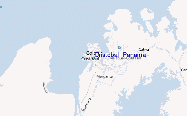
Use this relief map to navigate to tide stations, surf breaks and cities that are in the area of Cristobal, Panama.
Other Nearby Locations' tide tables and tide charts to Cristobal, Panama:
click location name for more details
 Surf breaks close to Cristobal, Panama:
|
||
|---|---|---|
| Closest surf break | Maria Chiquita | 4 mi |
| Second closest surf break | V-Land | 12 mi |
| Third closest surf break | Isla Grande | 30 mi |
| Fourth closest surf break | Playon | 30 mi |
| Fifth closest surf break | Palenque | 31 mi |


 Nearest
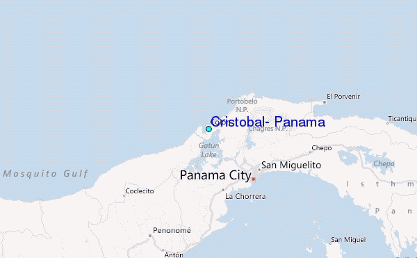