
| Distance / Altitude | Location | Report Date / Time | Live Weather | Wind | Gusts | Temp. | Visibility | Cloud |
|---|---|---|---|---|---|---|---|---|
| 4 km NW / 3 m | SHIP4685 (Marine) | 2026-06-13 05:30 local (2026/06/13 08:00 GMT) | moderate winds from the N (21 km/h at 360) | 6°C | - | |||
| 4 km NW / 3 m | SHIP5714 (Marine) | 2026-06-13 05:30 local (2026/06/13 08:00 GMT) | moderate winds from the N (21 km/h at 360) | 6°C | - | |||
| 4 km NW / 15 m | SHIP11920 (Marine) | 2026-06-13 05:30 local (2026/06/13 08:00 GMT) | moderate winds from the N (20.52 km/h at 360) | — | - km | |||
| 4 km NW / 3 m | SHIP11506 (Marine) | 2026-06-13 06:30 local (2026/06/13 09:00 GMT) | moderate winds from the N (26 km/h at 10) | 6°C | - | |||
| 4 km NW / 3 m | SHIP3192 (Marine) | 2026-06-13 05:30 local (2026/06/13 08:00 GMT) | moderate winds from the N (21 km/h at 360) | 6°C | - | |||
| 4 km NW / 3 m | SHIP5568 (Marine) | 2026-06-13 07:30 local (2026/06/13 10:00 GMT) | moderate winds from the N (22 km/h at 10) | 6°C | - | |||
| 4 km NW / 15 m | SHIP8551 (Marine) | 2026-06-13 05:30 local (2026/06/13 08:00 GMT) | moderate winds from the N (20.52 km/h at 360) | — | - km | |||
| 4 km NW / 3 m | SHIP5428 (Marine) | 2026-06-13 06:30 local (2026/06/13 09:00 GMT) | moderate winds from the N (26 km/h at 10) | 6°C | - | |||
| 4 km NW / 3 m | SHIP2332 (Marine) | 2026-06-13 05:30 local (2026/06/13 08:00 GMT) | moderate winds from the N (21 km/h at 360) | 6°C | - | |||
| 4 km NW / 3 m | SHIP7500 (Marine) | 2026-06-13 05:30 local (2026/06/13 08:00 GMT) | moderate winds from the N (21 km/h at 360) | 6°C | - |
| Contours: | Roads & Rivers: | Select a
tide station / surf break / city |
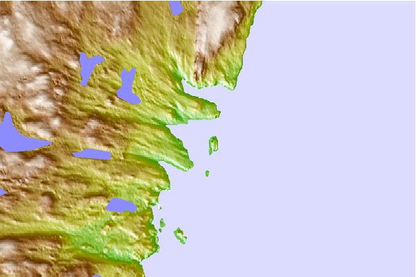
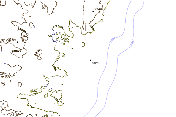
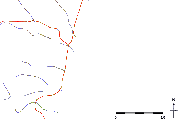
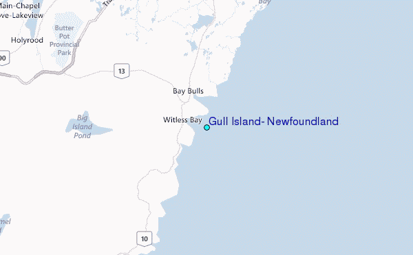
Use this relief map to navigate to tide stations, surf breaks and cities that are in the area of Gull Island, Newfoundland.
Other Nearby Locations' tide tables and tide charts to Gull Island, Newfoundland:
click location name for more details
 Surf breaks close to Gull Island, Newfoundland:
|
||
|---|---|---|
| Closest surf break | Kennington Cove | 359 mi |
| Second closest surf break | Ingonish Beach | 361 mi |
| Third closest surf break | Michaud Point | 394 mi |
| Fourth closest surf break | Martinique | 529 mi |
| Fifth closest surf break | Lawrencetown Left Point | 538 mi |


 Nearest
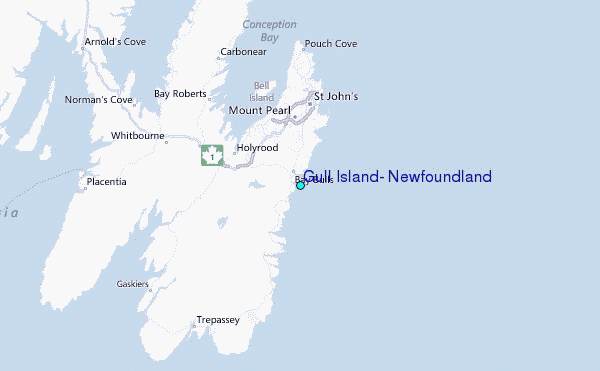