
| Distance / Altitude | Location | Report Date / Time | Live Weather | Wind | Gusts | Temp. | Visibility | Cloud |
|---|---|---|---|---|---|---|---|---|
| 61 km SE / 19 m | Cape Flattery (Australia) | 2024-04-27 03:00 local (2024/04/26 17:00 GMT) | no report | moderate winds from the ESE (22 km/h at 120) | 26°C | - | - no observation - | |
| 105 km SSE / 6 m | Cooktown Airport (Australia) | 2024-04-27 03:00 local (2024/04/26 17:00 GMT) | No report | moderate winds from the ESE (22 km/h at 120) | 26°C | - | - overcast - | |
| 192 km S / 240 m | Palmerville (Australia) | 2024-04-27 03:00 local (2024/04/26 17:00 GMT) | No report | calm (0 km/h at 0) | 19°C | - | no observation | |
| 216 km SSE / 4 m | Low Isles Lighthouse (Australia) | 2024-04-27 02:00 local (2024/04/26 16:00 GMT) | no report | - (- km/h at -) | 25°C | - | - - - | |
| 219 km W / 244 m | Coen Airport (Australia) | 2024-04-27 02:00 local (2024/04/26 16:00 GMT) | - | light winds from the SSE (9 km/h at 150) | 24°C | - | no observation |
| Contours: | Roads & Rivers: | Select a
tide station / surf break / city |
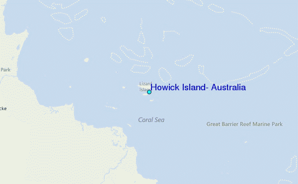
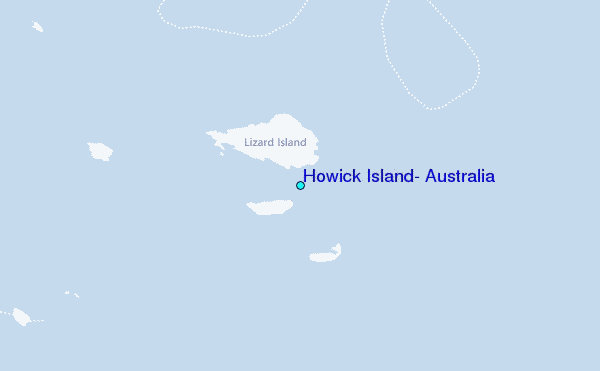
Use this relief map to navigate to tide stations, surf breaks and cities that are in the area of Howick Island, Australia.
Other Nearby Locations' tide tables and tide charts to Howick Island, Australia:
click location name for more details
 Surf breaks close to Howick Island, Australia:
|
||
|---|---|---|
| Closest surf break | Dolphin Heads | 528 mi |
| Second closest surf break | Eimeo Point | 528 mi |
| Third closest surf break | Lamberts Beach | 533 mi |
| Fourth closest surf break | North Wall Mackay Harbour Beach | 534 mi |
| Fifth closest surf break | South Wall Mackay Harbour | 535 mi |

 Nearest
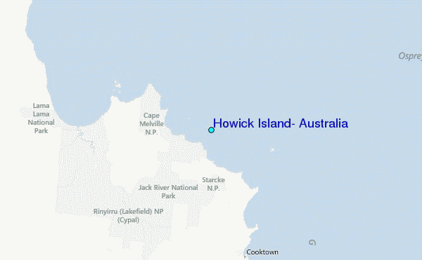