
| Distance / Altitude | Location | Report Date / Time | Live Weather | Wind | Gusts | Temp. | Visibility | Cloud |
|---|---|---|---|---|---|---|---|---|
| 2 km N / 5 m | Navegantes Airport (Brazil) | 2026-06-09 08:00 local (2026/06/09 11:00 GMT) | Dry and partly cloudy | calm (4 km/h at 230) | 17°C | 8.0 | scattered broken | |
| 4 km NNE / 5 m | Navegantes Airport (Brazil) | 2026-06-09 08:00 local (2026/06/09 11:00 GMT) | no report | wind obs. (7 kph from 340 degs) was rejected (- km/h at -) | 18°C | 20 | - | |
| 13 km S / 12 m | Balneario Camboriu (Brazil) | 2026-06-09 08:50 local (2026/06/09 11:50 GMT) | dry | calm (0 km/h at 199) | 17°C | - | - - 0 | |
| 17 km SSE / 109 m | Pescadores wx (Brazil) | 2026-06-09 09:18 local (2026/06/09 12:18 GMT) | dry | calm (2 km/h at 139) | 17°C | - | - - 0 | |
| 34 km SSW / 43 m | Brusque wx (Brazil) | 2026-06-09 08:18 local (2026/06/09 11:18 GMT) | dry | calm (0 km/h at 310) | 23°C | - | - - 0 | |
| 44 km SW / 54 m | Blumenau (Brazil) | 2026-06-09 08:51 local (2026/06/09 11:51 GMT) | dry | calm (0 km/h at 18) | 17°C | - | - - 0 | |
| 64 km SSE / 9 m | Ingleses do Rio Vermelho wx (Brazil) | 2026-06-09 08:04 local (2026/06/09 11:04 GMT) | - | - (- km/h at ) | 22°C | - | - - 0 | |
| 72 km NW / 132 m | Boa Vista wx (Brazil) | 2026-06-09 09:02 local (2026/06/09 12:02 GMT) | dry | calm (0 km/h at ) | 19°C | - | - - 0 | |
| 73 km S / 23 m | Jardim Zanelatto wx (Brazil) | 2026-06-09 08:37 local (2026/06/09 11:37 GMT) | - | - (- km/h at ) | 19°C | - | - - 0 | |
| 74 km S / 19 m | Ipiranga wx (Brazil) | 2026-06-09 08:40 local (2026/06/09 11:40 GMT) | - | - (- km/h at ) | 21°C | - | - - 0 |
| Contours: | Roads & Rivers: | Select a
tide station / surf break / city |
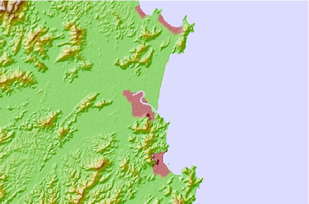
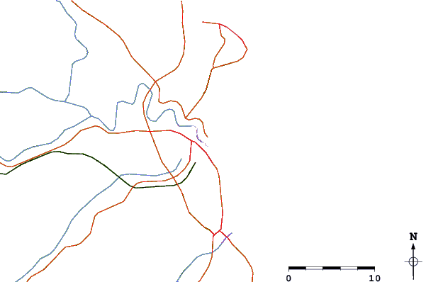
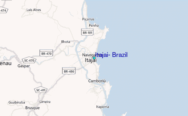
Use this relief map to navigate to tide stations, surf breaks and cities that are in the area of Itajai, Brazil.
Other Nearby Locations' tide tables and tide charts to Itajai, Brazil:
click location name for more details
 Surf breaks close to Itajai, Brazil:
|
||
|---|---|---|
| Closest surf break | Atalaia (Molhes) | 1 mi |
| Second closest surf break | Navegantes | 1 mi |
| Third closest surf break | Morcego | 2 mi |
| Fourth closest surf break | Praia Brava | 4 mi |
| Fifth closest surf break | Praia Dos Amores | 4 mi |


 Nearest