
| Distance / Altitude | Location | Report Date / Time | Live Weather | Wind | Gusts | Temp. | Visibility | Cloud |
|---|---|---|---|---|---|---|---|---|
| 19 km SSE / 474 m | Nagasaki Airport (Japan) | 2026-06-09 15:00 local (2026/06/09 06:00 GMT) | Dry and partly cloudy | light winds from the SE (11 km/h at 130) | 22°C | 10.0 | few scattered broken | |
| 44 km NNE / 10 m | Nabatake wx (Japan) | 2026-06-09 16:41 local (2026/06/09 07:41 GMT) | dry | calm (5 km/h at 19) | 23°C | - | - - 0 | |
| 46 km ENE / 5 m | Saga Airport (Japan) | 2026-06-09 15:00 local (2026/06/09 06:00 GMT) | Dry and partly cloudy | light winds from the SE (11 km/h at 140) | 22°C | 10.0 | few scattered broken | |
| 76 km N / 16 m | Iki Airport (isl (Japan) | 2026-06-09 15:00 local (2026/06/09 06:00 GMT) | Dry and partly cloudy | light winds from the NE (15 km/h at 50) | 22°C | 10.0 | no significant cloud | |
| 80 km NE / 218 m | Fukuoka/Itazuke Airport (Japan) | 2026-06-09 15:30 local (2026/06/09 06:30 GMT) | Dry and partly cloudy | light winds from the N (15 km/h at 350) | 23°C | 10.0 | few scattered broken | |
| 81 km ENE / 41 m | Haruda wx (Japan) | 2026-06-09 16:21 local (2026/06/09 07:21 GMT) | dry | calm (0 km/h at 180) | 24°C | - | - - 0 | |
| 87 km SSE / 93 m | Kuratake (Japan) | 2026-06-09 15:00 local (2026/06/09 06:00 GMT) | - | calm (0 km/h at 340) | 19°C | - | - - 0 | |
| 99 km ESE / 474 m | Kumamoto Airport (Japan) | 2026-06-09 15:00 local (2026/06/09 06:00 GMT) | Light rain | calm (2 km/h at 1) | 19°C | 10.0 | few broken | |
| 104 km SW / 27 m | Fukue Airport (Japan) | 2026-06-09 15:00 local (2026/06/09 06:00 GMT) | Shower light rain shower | light winds from the ESE.(Wind varies from 060 to 170 degs) (6 km/h at 120) | 21°C | 10.0 | few scattered broken | |
| 107 km NE / 9 m | Taku wx (Japan) | 2026-06-09 16:06 local (2026/06/09 07:06 GMT) | - | - (- km/h at ) | 26°C | - | - - 0 |

| Contours: | Roads & Rivers: | Select a
tide station / surf break / city |
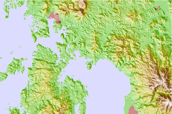
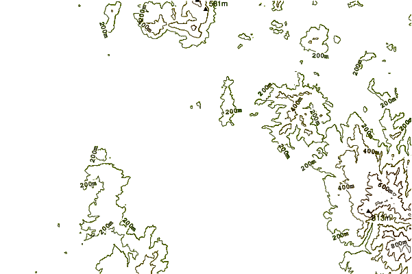
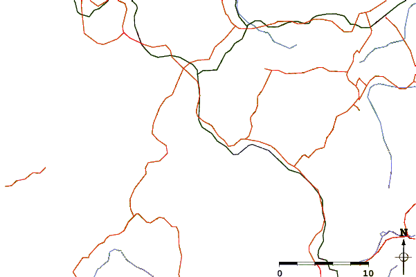
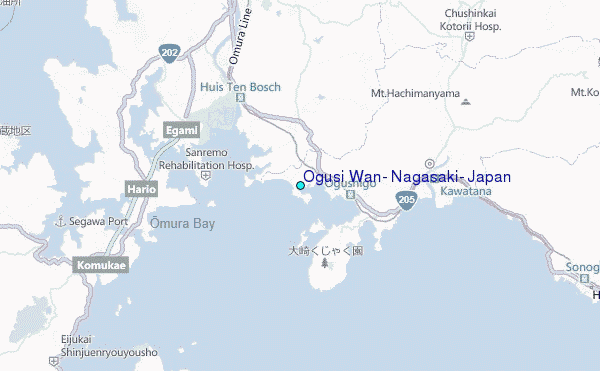
Use this relief map to navigate to tide stations, surf breaks and cities that are in the area of Ogusi Wan, Nagasaki, Japan.
Other Nearby Locations' tide tables and tide charts to Ogusi Wan, Nagasaki, Japan:
click location name for more details
 Surf breaks close to Ogusi Wan, Nagasaki, Japan:
|
||
|---|---|---|
| Closest surf break | Nomozaki | 18 mi |
| Second closest surf break | Fukuoka | 34 mi |
| Third closest surf break | Kodogawa | 115 mi |
| Fourth closest surf break | Okuragahama | 116 mi |
| Fifth closest surf break | Kanegahama | 116 mi |


 Nearest
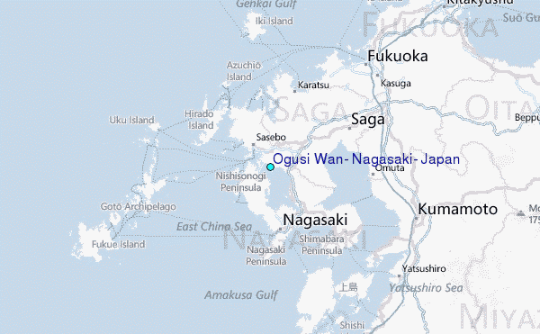