
| Distance / Altitude | Location | Report Date / Time | Live Weather | Wind | Gusts | Temp. | Visibility | Cloud |
|---|---|---|---|---|---|---|---|---|
| 61 km S / 101 m | Pamijen Lor wx (Indonesia) | 2025-12-18 01:38 local (2025/12/17 18:38 GMT) | - | - (- km/h at ) | 28°C | - | - - 0 | |
| 68 km ESE / 2039 m | Dieng Kulon wx (Indonesia) | 2025-12-18 00:05 local (2025/12/17 17:05 GMT) | - | wind obs. (32 kph from 92 degs) was rejected (- km/h at -) | 9°C | - | - - 0 | |
| 100 km S / 6 m | Cilacap (Indonesia) | 2025-12-18 01:00 local (2025/12/17 18:00 GMT) | Continuous light rain | calm (4 km/h at 220) | 26°C | 27 km | - mostly cloudy - | |
| 113 km E / 3 m | Achmad Yani (Indonesia) | 2025-12-18 01:00 local (2025/12/17 18:00 GMT) | State of sky unchanged | light winds from the ESE (6 km/h at 120) | 27°C | 26 km | mostly cloudy | |
| 113 km E / 5 m | Ahmad Yani International Airport (Indonesia) | 2025-12-18 01:00 local (2025/12/17 18:00 GMT) | State of sky unchanged | light winds from the ESE (6 km/h at 120) | 27°C | 26 km | few mostly cloudy broken | |
| 118 km E / 152 m | Bukitsari wx (Indonesia) | 2025-12-18 01:20 local (2025/12/17 18:20 GMT) | - | - (- km/h at ) | 26°C | - | - - 0 | |
| 118 km E / 152 m | Bukitsari wx (Indonesia) | 2025-12-18 00:19 local (2025/12/17 17:19 GMT) | - | - (- km/h at ) | 28°C | - | - - 0 | |
| 198 km WSW / 796 m | Srigunting wx (Indonesia) | 2025-12-18 01:08 local (2025/12/17 18:08 GMT) | - | light winds from the W (6 km/h at 263) | 26°C | - | - - 0 | |
| 201 km WSW / 820 m | Kalidam wx (Indonesia) | 2025-12-18 01:21 local (2025/12/17 18:21 GMT) | - | calm (0 km/h at 0) | — | - | - - 0 | |
| 269 km WSW / 481 m | Genteng wx (Indonesia) | 2025-12-18 01:44 local (2025/12/17 18:44 GMT) | - | calm (0 km/h at 0) | — | - | - - 0 |
| Contours: | Roads & Rivers: | Select a
tide station / surf break / city |
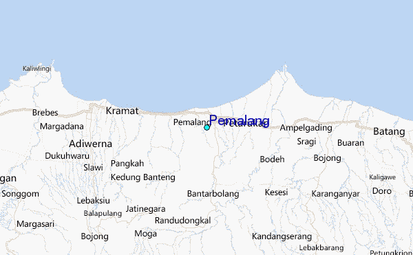
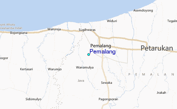
Use this relief map to navigate to tide stations, surf breaks and cities that are in the area of Pemalang.
Other Nearby Locations' tide tables and tide charts to Pemalang:
click location name for more details
 Surf breaks close to Pemalang:
|
||
|---|---|---|
| Closest surf break | Karang Nini | 70 mi |
| Second closest surf break | Batu Mandi | 75 mi |
| Third closest surf break | Batu Hiu | 79 mi |
| Fourth closest surf break | Batu Karas | 84 mi |
| Fifth closest surf break | Keusik Luhur | 87 mi |


 Nearest
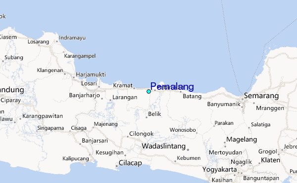