
| Distance / Altitude | Location | Report Date / Time | Live Weather | Wind | Gusts | Temp. | Visibility | Cloud |
|---|---|---|---|---|---|---|---|---|
| 30 km SE / 86 m | Sechelt- BC (Canada) | 2026-06-11 11:01 local (2026/06/11 18:01 GMT) | no report | wind obs. (7 kph from 150 degs) was rejected (- km/h at -) | 17°C | - | - no observation - | |
| 33 km S / 5 m | Ballenas Island Automatic (British columbia) | 2026-06-11 11:00 local (2026/06/11 18:00 GMT) | - | light winds from the E (13 km/h at 80) | 15°C | 0.0 | ||
| 33 km S / 10 m | Ballenas Island- BC (Canada) | 2026-06-11 11:00 local (2026/06/11 18:00 GMT) | no report | wind obs. (13 kph from 70 degs) was rejected (- km/h at -) | 15°C | - | - no observation - | |
| 33 km S / 5 m | Ballenas Island Automatic (British columbia) | 2026-06-11 10:00 local (2026/06/11 17:00 GMT) | - | light winds from the ENE (7 km/h at 60) | 15°C | 0.0 | ||
| 33 km SW / 20 m | Sisters Il Airport (Canada) | 2026-06-11 11:00 local (2026/06/11 18:00 GMT) | no report | wind obs. (25 kph from 300 degs) was rejected (- km/h at -) | 17°C | - | - no observation - | |
| 33 km SW / 217 m | Sisters Il Airport (British Columbia) | 2026-06-11 11:00 local (2026/06/11 18:00 GMT) | - | calm (2 km/h at 270) | 17°C | 0.0 | ||
| 39 km W / 387 m | Powell River Airport (British Columbia) | 2026-06-11 11:00 local (2026/06/11 18:00 GMT) | Dry and partly cloudy | light winds from the W.(Wind varies from 240 to 300 degs) (11 km/h at 270) | 16°C | 48 | few scattered broken | |
| 39 km SE / 3 m | Halibut Bank Buoy (Marine) | 2026-06-11 12:00 local (2026/06/11 19:00 GMT) | light winds from the E (7 km/h at 100) | 14°C | - | |||
| 40 km WNW / 125 m | Powell River- BC (Canada) | 2026-06-11 10:00 local (2026/06/11 17:00 GMT) | no report | - (- km/h at -) | 11°C | - | - | |
| 41 km ESE / 123 m | Port Mellon- BC (Canada) | 2026-06-11 11:00 local (2026/06/11 18:00 GMT) | no report | calm (0 km/h at 0) | 17°C | - | - no observation - |
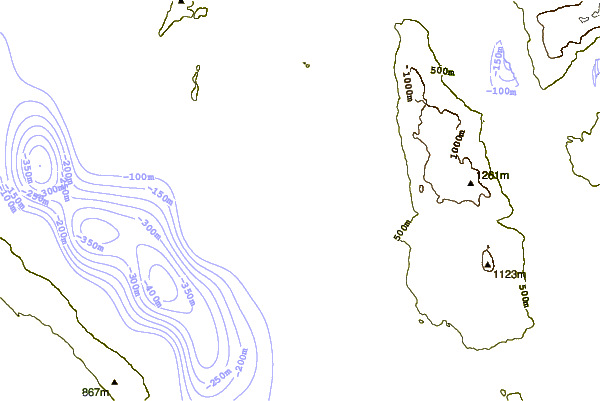
| Contours: | Roads & Rivers: | Select a
tide station / surf break / city |
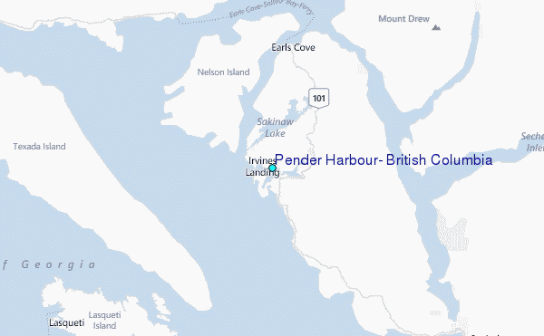
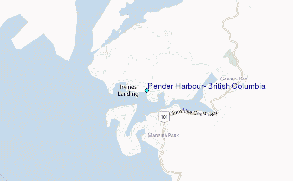
Use this relief map to navigate to tide stations, surf breaks and cities that are in the area of Pender Harbour, British Columbia.
Other Nearby Locations' tide tables and tide charts to Pender Harbour, British Columbia:
click location name for more details
 Surf breaks close to Pender Harbour, British Columbia:
|
||
|---|---|---|
| Closest surf break | Ambleside Park | 45 mi |
| Second closest surf break | Port Renfrew | 78 mi |
| Third closest surf break | Sombrio Beach | 82 mi |
| Fourth closest surf break | China Beach | 83 mi |
| Fifth closest surf break | Florencia Bay | 85 mi |


 Nearest
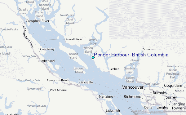