
| Distance / Altitude | Location | Report Date / Time | Live Weather | Wind | Gusts | Temp. | Visibility | Cloud |
|---|---|---|---|---|---|---|---|---|
| 15 km E / 13 m | Ponce (Puerto Rico) | 2026-06-09 04:46 local (2026/06/09 08:46 GMT) | dry | light winds from the N (6 km/h at 360) | 24°C | - | - - 0 | |
| 16 km E / 1 m | Muelle de Ponce wx (Puerto Rico) | 2026-06-09 04:34 local (2026/06/09 08:34 GMT) | dry | calm (5 km/h at 357) | 24°C | - | - - 0 | |
| 20 km S / 15 m | SHIP4520 (Marine) | 2026-06-09 03:00 local (2026/06/09 07:00 GMT) | - (- km/h at -) | — | - km | |||
| 21 km ENE / 443 m | Ponce/Mercedita Airport (Puerto Rico) | 2026-06-09 03:35 local (2026/06/09 07:35 GMT) | Clear | calm (0 km/h at 0) | 24°C | 16 | ||
| 20 km S / 15 m | SHIP7239 (Marine) | 2026-06-09 03:00 local (2026/06/09 07:00 GMT) | - (- km/h at -) | — | - km | |||
| 20 km S / 3 m | SHIP2286 (Marine) | 2026-06-09 03:00 local (2026/06/09 07:00 GMT) | - (- km/h at -) | 26°C | - | |||
| 20 km S / 3 m | SHIP2927 (Marine) | 2026-06-09 03:00 local (2026/06/09 07:00 GMT) | - (- km/h at -) | 26°C | - | |||
| 20 km S / 15 m | SHIP12254 (Marine) | 2026-06-09 03:00 local (2026/06/09 07:00 GMT) | - (- km/h at -) | — | - km | |||
| 21 km SSE / 15 m | SHIP3596 (Marine) | 2026-06-09 04:00 local (2026/06/09 08:00 GMT) | - (- km/h at -) | — | - km | |||
| 21 km SSE / 3 m | SHIP5670 (Marine) | 2026-06-09 04:00 local (2026/06/09 08:00 GMT) | - (- km/h at -) | 25°C | - |
| Contours: | Roads & Rivers: | Select a
tide station / surf break / city |
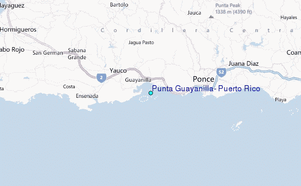
Use this relief map to navigate to tide stations, surf breaks and cities that are in the area of Punta Guayanilla, Puerto Rico.
Other Nearby Locations' tide tables and tide charts to Punta Guayanilla, Puerto Rico:
click location name for more details
 Surf breaks close to Punta Guayanilla, Puerto Rico:
|
||
|---|---|---|
| Closest surf break | Playa Ballena | 7 mi |
| Second closest surf break | Punta de Brea | 11 mi |
| Third closest surf break | Margara | 35 mi |
| Fourth closest surf break | Casa del Juez | 37 mi |
| Fifth closest surf break | Cueva del Indio | 37 mi |


 Nearest
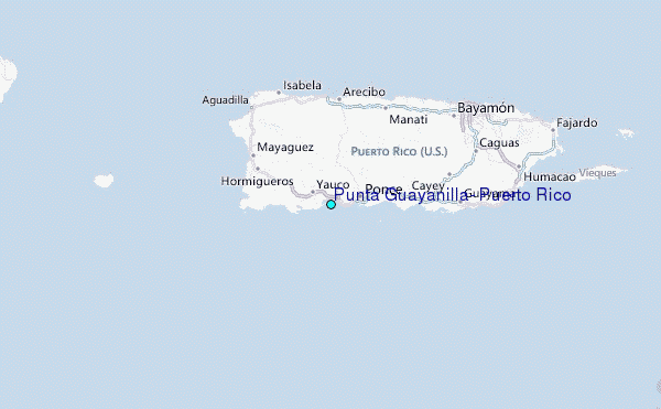