
| Distance / Altitude | Location | Report Date / Time | Live Weather | Wind | Gusts | Temp. | Visibility | Cloud |
|---|---|---|---|---|---|---|---|---|
| 31 km NW / 13 m | Horn Island Airport (Australia) | 2026-06-09 14:30 local (2026/06/09 04:30 GMT) | Dry and cloudy | fresh winds from the ESE (33 km/h at 120) | 28°C | 10.0 | scattered overcast | |
| 31 km NW / 5 m | Horn Island Automatic Weather Station (Australia) | 2026-06-09 15:00 local (2026/06/09 05:00 GMT) | no report | light winds from the SE (19 km/h at 140) | 26°C | - | - overcast - | |
| 162 km N / 15 m | SHIP6436 (Marine) | 2026-06-09 14:00 local (2026/06/09 04:00 GMT) | - (- km/h at -) | 28°C | - km | |||
| 199 km S / 40 m | SchergerRaaf (Australia) | 2026-06-09 15:00 local (2026/06/09 05:00 GMT) | no report | light winds from the ESE (6 km/h at 110) | 22°C | - | - scattered - | |
| 210 km S / 471 m | Weipa Aerodrome (Australia) | 2026-06-09 15:00 local (2026/06/09 05:00 GMT) | no report | light winds from the E (15 km/h at 100) | 24°C | - | - few - | |
| 161 km N / 3 m | SHIP5009 (Marine) | 2026-06-09 15:00 local (2026/06/09 05:00 GMT) | - (- km/h at -) | 27°C | - | |||
| 161 km N / 15 m | SHIP5335 (Marine) | 2026-06-09 15:00 local (2026/06/09 05:00 GMT) | - (- km/h at -) | 28°C | - km | |||
| 161 km N / 3 m | SHIP4596 (Marine) | 2026-06-09 14:00 local (2026/06/09 04:00 GMT) | - (- km/h at -) | 27°C | - | |||
| 198 km S / 40 m | SchergerRaaf (Australia) | 2026-06-09 15:00 local (2026/06/09 05:00 GMT) | no report | light winds from the ESE (6 km/h at 110) | 22°C | - | - scattered - | |
| 208 km S / 471 m | Weipa Aerodrome (Australia) | 2026-06-09 15:00 local (2026/06/09 05:00 GMT) | no report | light winds from the E (15 km/h at 100) | 24°C | - | - few - |
| Contours: | Roads & Rivers: | Select a
tide station / surf break / city |
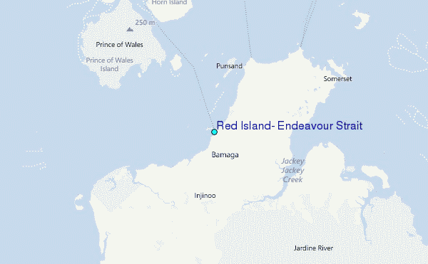
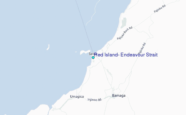
Use this relief map to navigate to tide stations, surf breaks and cities that are in the area of Red Island, Endeavour Strait.
Other Nearby Locations' tide tables and tide charts to Red Island, Endeavour Strait:
click location name for more details
 Surf breaks close to Red Island, Endeavour Strait:
|
||
|---|---|---|
| Closest surf break | Tupira Right | 490 mi |
| Second closest surf break | Forok Point | 509 mi |
| Third closest surf break | The Wharf (Mission Point) | 511 mi |
| Fourth closest surf break | Wewak Point | 512 mi |
| Fifth closest surf break | Moem Point | 513 mi |


 Nearest
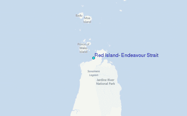