
| Distance / Altitude | Location | Report Date / Time | Live Weather | Wind | Gusts | Temp. | Visibility | Cloud |
|---|---|---|---|---|---|---|---|---|
| 4 km SSE / 60 m | Sandnes (Norway) | 2025-12-25 09:18 local (2025/12/25 08:18 GMT) | - | calm (0 km/h at 0) | 1°C | - | - - 0 | |
| 4 km W / 25 m | Stavanger/Sola (1415 -1) (Norway) | 2025-12-25 10:00 local (2025/12/25 09:00 GMT) | Clear skies | light winds from the N (7 km/h at 10) | -1°C | 35 | - clear - | |
| 4 km S / 30 m | Ganddal wx (Norway) | 2025-12-25 09:40 local (2025/12/25 08:40 GMT) | - | calm (0 km/h at 288) | -2°C | - | - - 0 | |
| 7 km W / 219 m | Stavanger Airport, Sola (Norway) | 2025-12-25 09:20 local (2025/12/25 08:20 GMT) | Dry and partly cloudy | light winds from the N (9 km/h at 10) | 0°C | 10.0 | scattered - - | |
| 8 km NW / 19 m | Hafrsfjord South 743 (Norway) | 2025-12-25 10:00 local (2025/12/25 09:00 GMT) | - | light winds from the N (6 km/h at 0) | 1°C | - | - - 0 | |
| 10 km NW / 55 m | Stavanger (Norway) | 2025-12-25 10:15 local (2025/12/25 09:15 GMT) | - | calm (2 km/h at 169) | — | - | - - 0 | |
| 11 km SSE / 134 m | Opstad wx (Norway) | 2025-12-25 10:13 local (2025/12/25 09:13 GMT) | dry | calm (0 km/h at 167) | — | - | - - 0 | |
| 11 km S / 87 m | Saerheim (Norway) | 2025-12-25 10:00 local (2025/12/25 09:00 GMT) | - | wind obs. (7 kph from 310 degs) was rejected (- km/h at -) | — | - | - | |
| 12 km N / 33 m | Våland (Stavanger) (Norway) | 2025-12-25 09:00 local (2025/12/25 08:00 GMT) | - | - (- km/h at -) | — | - | - | |
| 12 km SE / 168 m | Aalgaard (Norway) | 2025-12-25 09:34 local (2025/12/25 08:34 GMT) | dry | calm (0 km/h at ) | 3°C | - | - - 0 |
| Contours: | Roads & Rivers: | Select a
tide station / surf break / city |
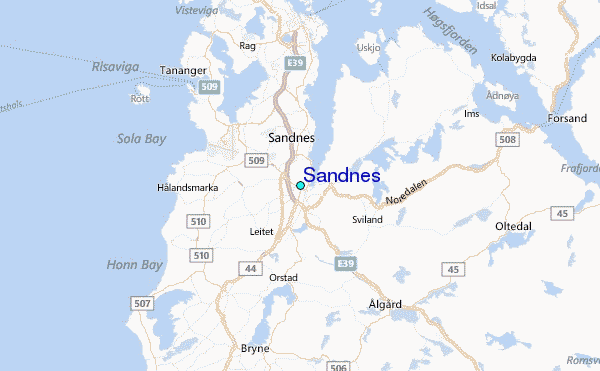
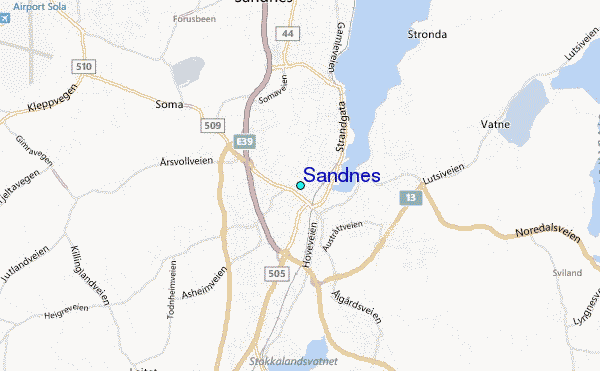
Use this relief map to navigate to tide stations, surf breaks and cities that are in the area of Sandnes.
Other Nearby Locations' tide tables and tide charts to Sandnes:
click location name for more details
 Surf breaks close to Sandnes:
|
||
|---|---|---|
| Closest surf break | Hellesto | 6 mi |
| Second closest surf break | Bore | 7 mi |
| Third closest surf break | Reve Havn | 7 mi |
| Fourth closest surf break | Sele | 7 mi |
| Fifth closest surf break | Lista (Bausje) | 62 mi |


 Nearest
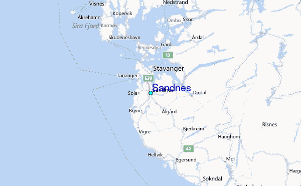