
| Distance / Altitude | Location | Report Date / Time | Live Weather | Wind | Gusts | Temp. | Visibility | Cloud |
|---|---|---|---|---|---|---|---|---|
| 8 km SE / 172 m | Singapore/Seletar Airport (Singapore) | 2026-06-09 11:00 local (2026/06/09 03:00 GMT) | Dry and partly cloudy | calm (4 km/h at 1) | 29°C | 10.0 | few broken | |
| 15 km WNW / 7 m | Kampung Paya Kenangan wx (Malaysia) | 2026-06-09 11:42 local (2026/06/09 03:42 GMT) | - | - (- km/h at ) | 32°C | - | - - 0 | |
| 16 km SE / 171 m | Paya Lebar Airport (Singapore) | 2026-06-09 11:00 local (2026/06/09 03:00 GMT) | Shower - in the vicinity | light winds from the W (6 km/h at 260) | 30°C | 10.0 | scattered broken | |
| 21 km ESE / 14 m | Singapore-Changi Airport (Singapore) | 2026-06-09 11:00 local (2026/06/09 03:00 GMT) | Thunderstorm heavy rain thunderstorm | light winds from the S.(Wind varies from 150 to 250 degs) (15 km/h at 180) | 28°C | 2.5 | few few scattered | |
| 24 km WNW / 217 m | Johore Bharu/Senai Airport (Malaysia) | 2026-06-09 11:00 local (2026/06/09 03:00 GMT) | Dry and partly cloudy | light winds from the WNW.(Wind varies from 250 to 350 degs) (7 km/h at 300) | 29°C | 10.0 | few scattered | |
| 25 km WNW / 40 m | JohoreBharuSenai (Malaysia) | 2026-06-09 11:00 local (2026/06/09 03:00 GMT) | distant precipitation but not falling at station | wind obs. (7 kph from 300 degs) was rejected (- km/h at -) | 31°C | 10 | - mostly cloudy - | |
| 51 km SE / 38 m | Hang Nadim (Indonesia) | 2026-06-09 11:38 local (2026/06/09 03:38 GMT) | Dry and partly cloudy | light winds from the WSW (13 km/h at 240) | 30°C | 9.0 | scattered scattered overcast | |
| 76 km E / 15 m | SHIP3738 (Marine) | 2026-06-09 11:00 local (2026/06/09 03:00 GMT) | - (- km/h at -) | — | - km | |||
| 99 km E / 15 m | SHIP4503 (Marine) | 2026-06-09 10:00 local (2026/06/09 02:00 GMT) | - (- km/h at -) | — | - km | |||
| 99 km SE / 18 m | Raja Haji Fisabilillah International Airport (Indonesia) | 2026-06-09 11:30 local (2026/06/09 03:30 GMT) | Dry and partly cloudy | light winds from the WSW.(Wind varies from 170 to 310 degs) (6 km/h at 240) | 30°C | 10.0 | few scattered |
| Contours: | Roads & Rivers: | Select a
tide station / surf break / city |
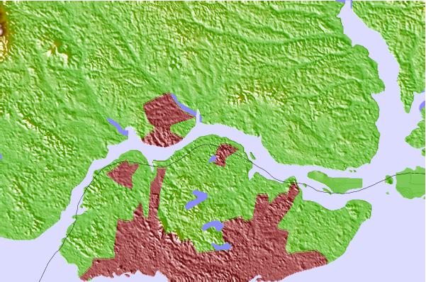
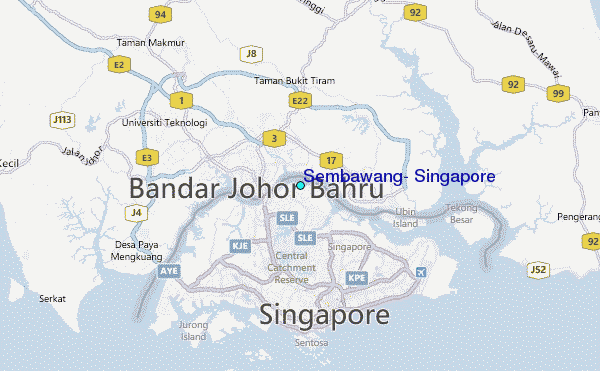
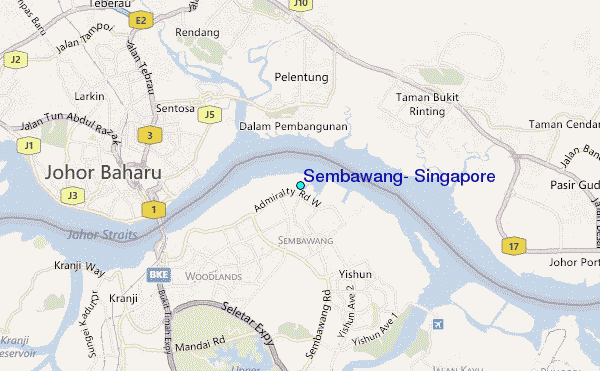
Use this relief map to navigate to tide stations, surf breaks and cities that are in the area of Sembawang, Singapore.
Other Nearby Locations' tide tables and tide charts to Sembawang, Singapore:
click location name for more details
 Surf breaks close to Sembawang, Singapore:
|
||
|---|---|---|
| Closest surf break | Tioman Island | 95 mi |
| Second closest surf break | Cherating | 186 mi |
| Third closest surf break | Kijal | 200 mi |
| Fourth closest surf break | Kelulut (Marang) | 259 mi |
| Fifth closest surf break | Batu Buruk | 271 mi |


 Nearest
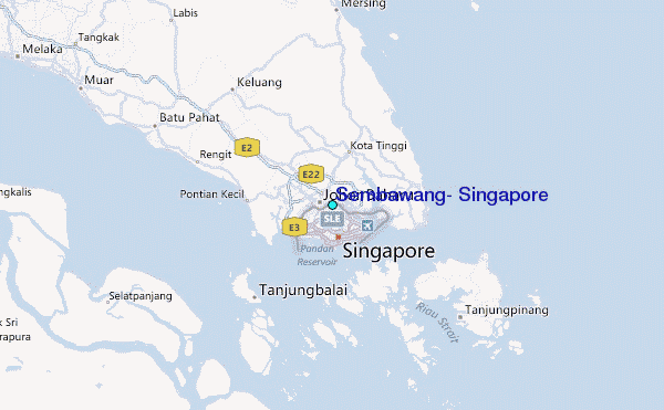