
| Distance / Altitude | Location | Report Date / Time | Live Weather | Wind | Gusts | Temp. | Visibility | Cloud |
|---|---|---|---|---|---|---|---|---|
| 85 km SW / 130 m | Tawau (Malaysia) | 2025-12-25 17:00 local (2025/12/25 09:00 GMT) | Clouds dissolving | calm (0 km/h at 150) | 28°C | 35 km | mostly cloudy | |
| 86 km SW / 215 m | Tawau/Kalimantan Airport (Malaysia) | 2025-12-25 17:00 local (2025/12/25 09:00 GMT) | - | calm (0 km/h at 0) | 28°C | 10.0 | few | |
| 157 km NW / 3 m | SHIP6651 (Marine) | 2025-12-25 17:00 local (2025/12/25 09:00 GMT) | - (- km/h at -) | 30°C | - | |||
| 169 km NW / 215 m | Sandakan Airport (Malaysia) | 2025-12-25 17:00 local (2025/12/25 09:00 GMT) | Haze | light winds from the NNE (13 km/h at 30) | 29°C | 32 km | few mostly cloudy - | |
| 172 km SSW / 50 m | Juwata Airport (Indonesia) | 2025-12-25 17:30 local (2025/12/25 09:30 GMT) | - | light winds from the E (6 km/h at 80) | 30°C | 10.0 | few | |
| 156 km NW / 15 m | SHIP5944 (Marine) | 2025-12-25 17:00 local (2025/12/25 09:00 GMT) | - (- km/h at -) | 30°C | - km | |||
| 156 km NW / 3 m | SHIP6048 (Marine) | 2025-12-25 16:00 local (2025/12/25 08:00 GMT) | - (- km/h at -) | 30°C | - | |||
| 156 km NW / 15 m | SHIP7518 (Marine) | 2025-12-25 16:00 local (2025/12/25 08:00 GMT) | - (- km/h at -) | 30°C | - km | |||
| 156 km NW / 15 m | SHIP4400 (Marine) | 2025-12-25 16:00 local (2025/12/25 08:00 GMT) | - (- km/h at -) | 30°C | - km | |||
| 156 km NW / 15 m | SHIP3110 (Marine) | 2025-12-25 16:00 local (2025/12/25 08:00 GMT) | - (- km/h at -) | 30°C | - km |

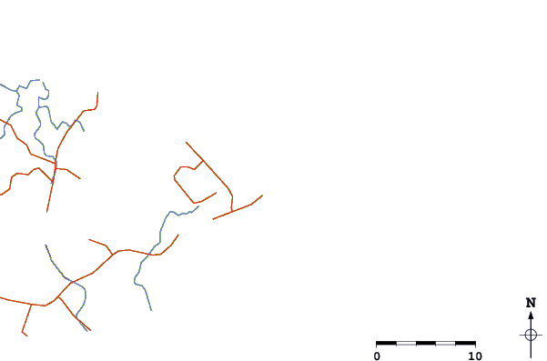
| Contours: | Roads & Rivers: | Select a
tide station / surf break / city |
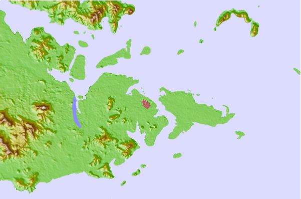
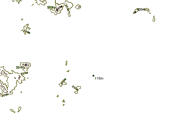
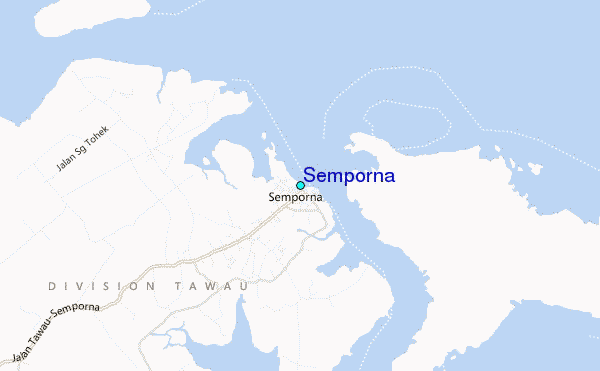
Use this relief map to navigate to tide stations, surf breaks and cities that are in the area of Semporna.
Other Nearby Locations' tide tables and tide charts to Semporna:
click location name for more details
 Surf breaks close to Semporna:
|
||
|---|---|---|
| Closest surf break | Kota Belud | 202 mi |
| Second closest surf break | Tanjung Aru Beach | 203 mi |
| Third closest surf break | Shabandar | 206 mi |
| Fourth closest surf break | Nexus West End | 206 mi |
| Fifth closest surf break | Nexus | 206 mi |


 Nearest