
| Distance / Altitude | Location | Report Date / Time | Live Weather | Wind | Gusts | Temp. | Visibility | Cloud |
|---|---|---|---|---|---|---|---|---|
| 195 km WNW / 210 m | Macatan Airport (Philippines) | 2025-12-23 01:00 local (2025/12/22 17:00 GMT) | Dry and partly cloudy | calm (2 km/h at 1) | 26°C | 10.0 | scattered broken | |
| 205 km SE / 20 m | BRAVO SIARGAO (Philippines) | 2025-12-23 02:00 local (2025/12/22 18:00 GMT) | - | light winds from the E (11 km/h at 91) | 27°C | - | - - 0 | |
| 240 km SSE / 36 m | Del Pilar wx (Philippines) | 2025-12-23 01:07 local (2025/12/22 17:07 GMT) | dry | calm (0 km/h at 0) | 24°C | - | - - 0 | |
| 251 km SE / 0 m | lightning 71km ENE of Union (Philippines) | 2025-12-22 23:46 local (2025/12/22 15:46 GMT) | Thunderstorm | (- km/h at -) | — | |||
| 257 km S / 0 m | lightning 27km SW of Catarman (Philippines) | 2025-12-23 01:15 local (2025/12/22 17:15 GMT) | Thunderstorm | (- km/h at -) | — | |||
| 282 km SSW / 8 m | Dumaguete (Philippines) | 2025-12-23 02:00 local (2025/12/22 18:00 GMT) | Dry and cloudy | wind obs. (7 kph from 250 degs) was rejected (- km/h at -) | 25°C | 10.0 | scattered overcast | |
| 282 km WSW / 80 m | Dalipdip wx (Philippines) | 2025-12-23 01:08 local (2025/12/22 17:08 GMT) | dry | calm (0 km/h at 359) | 23°C | - | - - 0 | |
| 289 km S / 0 m | lightning 41km NNE of Lopez Jaena (Philippines) | 2025-12-23 00:19 local (2025/12/22 16:19 GMT) | Thunderstorm | (- km/h at -) | — | |||
| 291 km WSW / 6 m | Kalibo/panay Isl (Philippines) | 2025-12-23 02:00 local (2025/12/22 18:00 GMT) | Shower heavy rain shower | light winds from the WSW.(Wind varies from 210 to 270 degs) (11 km/h at 240) | 24°C | 3.0 | broken overcast | |
| 353 km S / 1 m | Olingan wx (Philippines) | 2025-12-23 01:29 local (2025/12/22 17:29 GMT) | dry | calm (0 km/h at 186) | 26°C | - | - - 0 |
| Contours: | Roads & Rivers: | Select a
tide station / surf break / city |
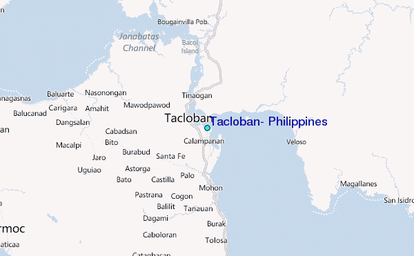
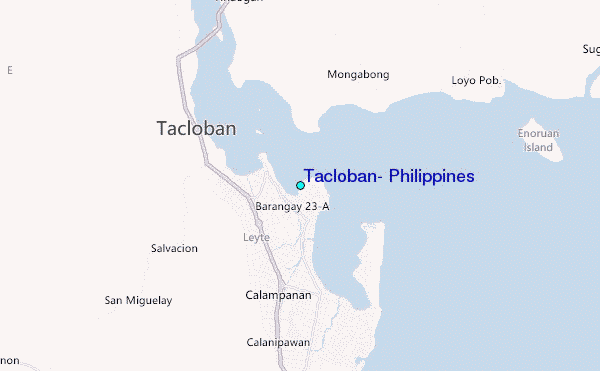
Use this relief map to navigate to tide stations, surf breaks and cities that are in the area of Tacloban, Philippines.
Other Nearby Locations' tide tables and tide charts to Tacloban, Philippines:
click location name for more details
 Surf breaks close to Tacloban, Philippines:
|
||
|---|---|---|
| Closest surf break | Boulevard | 39 mi |
| Second closest surf break | Guitagican Beach | 39 mi |
| Third closest surf break | Llorente | 39 mi |
| Fourth closest surf break | Pirates Cove | 39 mi |
| Fifth closest surf break | Santa Monica | 41 mi |


 Nearest
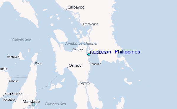