
| Distance / Altitude | Location | Report Date / Time | Live Weather | Wind | Gusts | Temp. | Visibility | Cloud |
|---|---|---|---|---|---|---|---|---|
| 40 km N / 211 m | Haeju (North Korea) | 2026-06-09 18:00 local (2026/06/09 09:00 GMT) | - | light winds from the NW (11 km/h at 320) | 21°C | 30 km | overcast | |
| 58 km SSE / 15 m | SHIP5099 (Marine) | 2026-06-09 17:00 local (2026/06/09 08:00 GMT) | calm (0.0 km/h at 140) | 16°C | - km | |||
| 58 km SSE / 3 m | West of Deokjeokdo Island- South Korea (Marine) | 2026-06-09 19:00 local (2026/06/09 10:00 GMT) | calm (4 km/h at 10) | 17°C | - | |||
| 81 km ENE / 208 m | Kaesong (North Korea) | 2026-06-09 18:00 local (2026/06/09 09:00 GMT) | - | light winds from the SW (11 km/h at 230) | 22°C | 50 km | mostly cloudy | |
| 94 km WNW / 209 m | Ryongyon (North Korea) | 2026-06-09 18:00 local (2026/06/09 09:00 GMT) | Continuous light rain | calm (0 km/h at 0) | 20°C | 4.0 km | overcast | |
| 58 km SSE / 15 m | SHIP4761 (Marine) | 2026-06-09 18:00 local (2026/06/09 09:00 GMT) | calm (3.6 km/h at 240) | 17°C | - km | |||
| 58 km SSE / 15 m | SHIP6121 (Marine) | 2026-06-09 17:00 local (2026/06/09 08:00 GMT) | calm (0.0 km/h at 140) | 16°C | - km | |||
| 58 km SSE / 15 m | SHIP3164 (Marine) | 2026-06-09 17:00 local (2026/06/09 08:00 GMT) | calm (0.0 km/h at 140) | 16°C | - km | |||
| 58 km SSE / 3 m | West of Deokjeokdo Island- South Korea (Marine) | 2026-06-09 19:00 local (2026/06/09 10:00 GMT) | calm (4 km/h at 10) | 17°C | - | |||
| 58 km SSE / 15 m | SHIP8667 (Marine) | 2026-06-09 17:00 local (2026/06/09 08:00 GMT) | calm (0.0 km/h at 140) | 16°C | - km |
| Contours: | Roads & Rivers: | Select a
tide station / surf break / city |
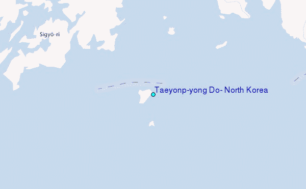
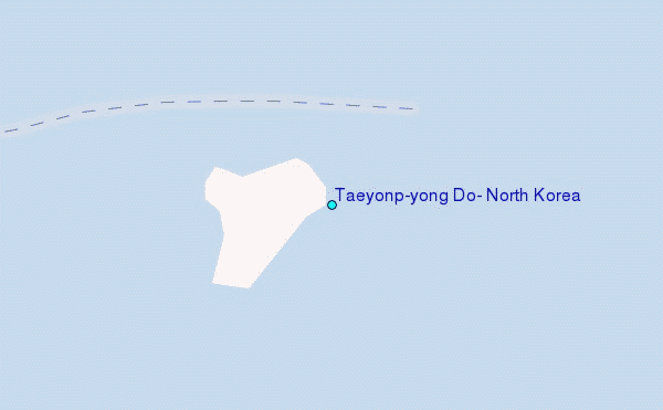
Use this relief map to navigate to tide stations, surf breaks and cities that are in the area of Taeyonp'yong Do, North Korea.
Other Nearby Locations' tide tables and tide charts to Taeyonp'yong Do, North Korea:
click location name for more details
 Surf breaks close to Taeyonp'yong Do, North Korea:
|
||
|---|---|---|
| Closest surf break | Songdojin ni | 158 mi |
| Second closest surf break | Ingu Beach | 167 mi |
| Third closest surf break | 38 Line | 167 mi |
| Fourth closest surf break | Jumunjin | 171 mi |
| Fifth closest surf break | Gyongpo Beach | 175 mi |


 Nearest
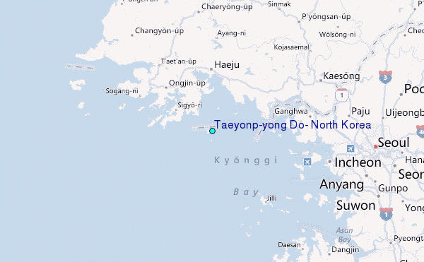