
| Distance / Altitude | Location | Report Date / Time | Live Weather | Wind | Gusts | Temp. | Visibility | Cloud |
|---|---|---|---|---|---|---|---|---|
| 68 km NNE / 6 m | Tumaco/la Florid (Colombia) | 2025-12-24 19:00 local (2025/12/25 00:00 GMT) | Dry and partly cloudy | light winds from the W (9 km/h at 270) | 25°C | 10.0 | broken | |
| 142 km SE / 2952 m | AEP Yuracrucito (Ecuador) | 2025-12-24 20:00 local (2025/12/25 01:00 GMT) | - | calm (0 km/h at 344) | 12°C | - | - - 0 | |
| 159 km ESE / 2905 m | Ipiales/San Luis Airport (Columbia) | 2025-12-24 19:00 local (2025/12/25 00:00 GMT) | - | light winds from the N.(Wind varies from 330 to 030 degs) (13 km/h at 360) | 13°C | 10.0 | ||
| 167 km SSE / 2400 m | Quito New International Airport (Ecuador) | 2025-12-24 19:00 local (2025/12/25 00:00 GMT) | Dry and partly cloudy | wind obs. (17 kph from 360 degs) was rejected (- km/h at -) | 15°C | 10.0 | broken | |
| 189 km NE / 54 m | Guapi (Colombia) | 2025-12-24 18:00 local (2025/12/24 23:00 GMT) | Dry and partly cloudy | wind obs. (6 kph from 1 degs) was rejected (- km/h at -) | 25°C | 10.0 | scattered broken | |
| 191 km E / 2627 m | Acuapasto wx (Colombia) | 2025-12-24 19:14 local (2025/12/25 00:14 GMT) | - | calm (5 km/h at 317) | 12°C | - | - - 0 | |
| 192 km E / 1709 m | Pasto-Antonio Nariño Airport (Columbia) | 2025-12-24 19:00 local (2025/12/25 00:00 GMT) | - | calm (4 km/h at 1) | 17°C | 10.0 | ||
| 223 km S / 3200 m | Latacunga (Ecuador) | 2025-12-24 20:41 local (2025/12/25 01:41 GMT) | dry | calm (0 km/h at 257) | 9°C | - | - - 0 | |
| 243 km S / 2768 m | Latacunga/Cotopaxi Airport (Ecuador) | 2025-12-24 19:00 local (2025/12/25 00:00 GMT) | Dry and partly cloudy | light winds from the N (19 km/h at 350) | 13°C | 10.0 | scattered scattered | |
| 288 km E / 511 m | Puerto Guzmán wx (Colombia) | 2025-12-24 20:08 local (2025/12/25 01:08 GMT) | dry | calm (2 km/h at 144) | 27°C | - | - - 0 |
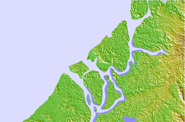
| Contours: | Roads & Rivers: | Select a
tide station / surf break / city |
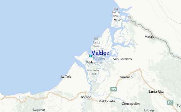
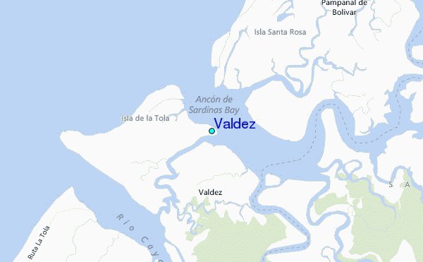
Use this relief map to navigate to tide stations, surf breaks and cities that are in the area of Valdez.
Other Nearby Locations' tide tables and tide charts to Valdez:
click location name for more details
 Surf breaks close to Valdez:
|
||
|---|---|---|
| Closest surf break | Tumaco | 40 mi |
| Second closest surf break | Atacames | 65 mi |
| Third closest surf break | Casablanca | 71 mi |
| Fourth closest surf break | Tonchigue | 73 mi |
| Fifth closest surf break | Punta Galera | 81 mi |


 Nearest
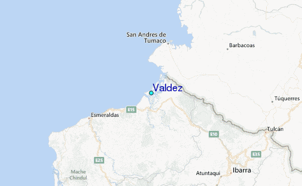