
| Distance / Altitude | Location | Report Date / Time | Live Weather | Wind | Gusts | Temp. | Visibility | Cloud |
|---|---|---|---|---|---|---|---|---|
| 5 km W / 218 m | Vero Beach Airport (Florida) | 2025-12-17 12:53 local (2025/12/17 17:53 GMT) | Dry and cloudy | light winds from the E (17 km/h at 90) | 24°C | 16 | scattered overcast | |
| 15 km S / 218 m | Fort Pierce Airport (Florida) | 2025-12-17 12:53 local (2025/12/17 17:53 GMT) | Dry and partly cloudy | light winds from the E (17 km/h at 90) | 25°C | 16 | few scattered | |
| 18 km ESE / 3 m | Fort Pierce- FL (Marine) | 2025-12-17 13:56 local (2025/12/17 18:56 GMT) | - (- km/h at -) | — | - | |||
| 19 km ESE / 3 m | BUOY-41068 (Marine) | 2025-12-17 13:08 local (2025/12/17 18:08 GMT) | light winds from the SE (18 km/h at 130) | 23°C | - | |||
| 24 km NW / 6 m | Sebastian Airport (Florida) (Florida) | 2025-12-17 13:35 local (2025/12/17 18:35 GMT) | Dry and cloudy | light winds from the E.(Wind varies from 070 to 130 degs) (19 km/h at 90) | 25°C | 16 | overcast | |
| 26 km NW / 3 m | BUOY-SIPF1 (Marine) | 2025-12-17 13:30 local (2025/12/17 18:30 GMT) | - (0 km/h at -) | 22°C | - | |||
| 52 km SSE / 240 m | Stuart/Witham Field Airport (Florida) | 2025-12-17 12:50 local (2025/12/17 17:50 GMT) | Dry and partly cloudy | light winds from the E (19 km/h at 100) | 25°C | 11 | broken | |
| 58 km NW / 218 m | Melbourne Airport (Florida) | 2025-12-17 12:53 local (2025/12/17 17:53 GMT) | Dry and cloudy | light winds from the E (11 km/h at 100) | 23°C | 16 | broken overcast | |
| 63 km SSW / 215 m | Okeechobee County Airport (FL) (United States) | 2025-12-17 13:35 local (2025/12/17 18:35 GMT) | Clear | light winds from the N (9 km/h at 1) | 26°C | 16 | ||
| 68 km NW / 217 m | Patrick Air Force Base Airport (Florida) | 2025-12-17 13:35 local (2025/12/17 18:35 GMT) | Dry and partly cloudy | light winds from the ESE (19 km/h at 120) | 25°C | 16 | scattered |
| Contours: | Roads & Rivers: | Select a
tide station / surf break / city |
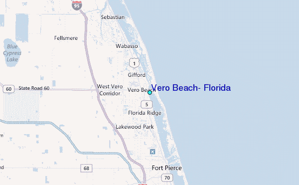
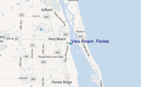
Use this relief map to navigate to tide stations, surf breaks and cities that are in the area of Vero Beach, Florida.
Other Nearby Locations' tide tables and tide charts to Vero Beach, Florida:
click location name for more details
 Surf breaks close to Vero Beach, Florida:
|
||
|---|---|---|
| Closest surf break | Riomar Reef | 1 mi |
| Second closest surf break | Vero Beach Pier | 5 mi |
| Third closest surf break | Wabasso | 10 mi |
| Fourth closest surf break | Fort Pierce North Jetty | 13 mi |
| Fifth closest surf break | Monster Hole | 15 mi |


 Nearest
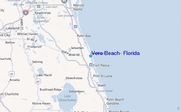